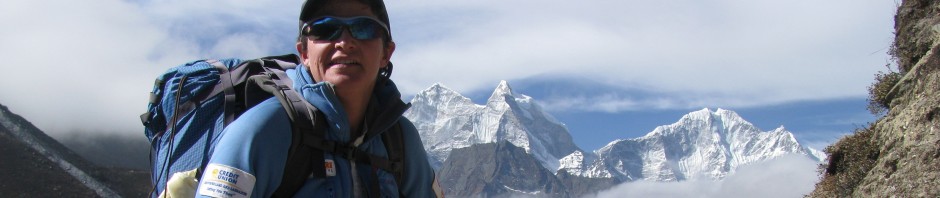
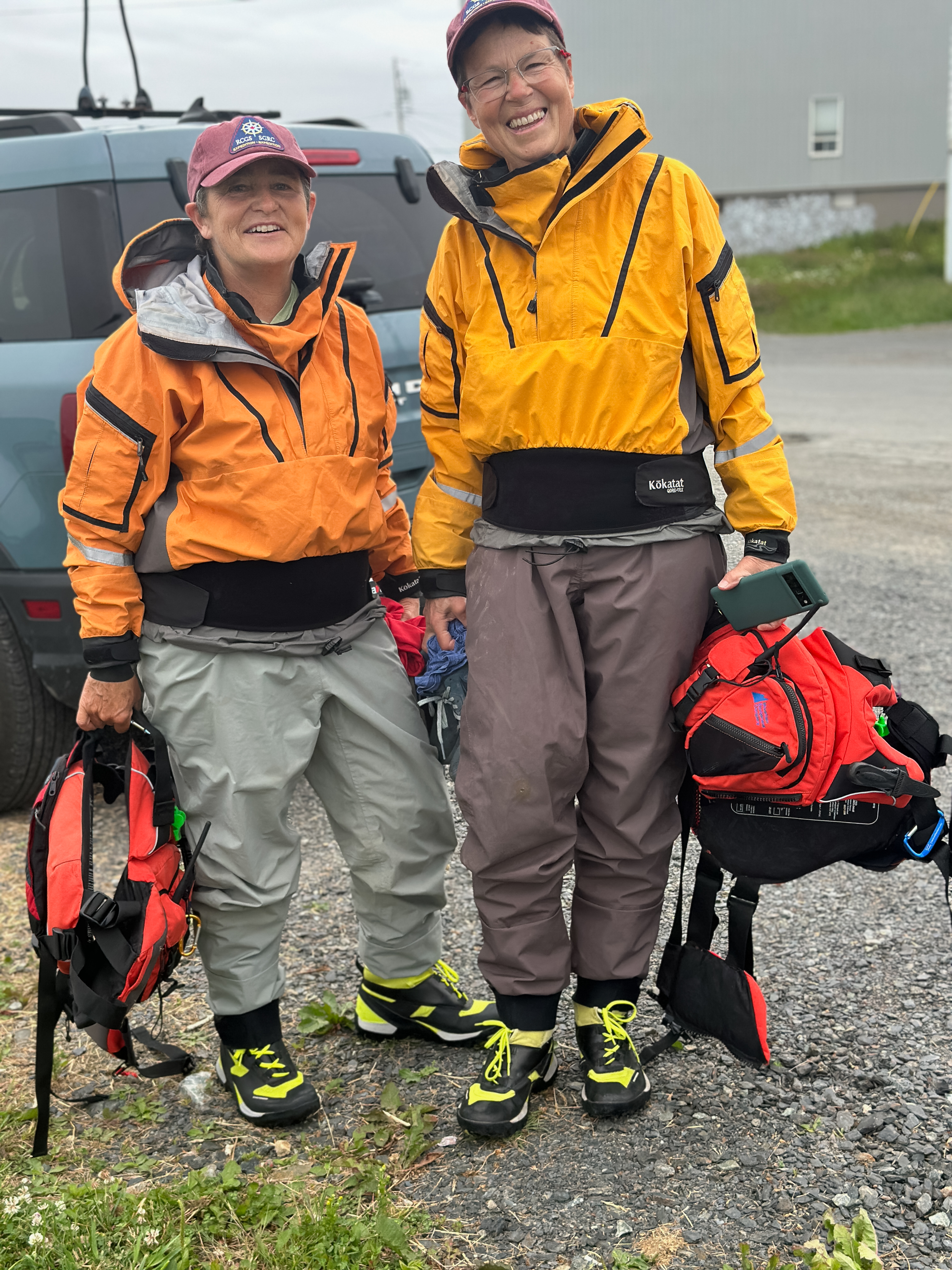
Our sea kayaking expedition was inspired by the well-known and loved Newfoundland folk song, I’s the B’y. Our goal, like the song’s lyrics, was to paddle “All Around the Circle,” exploring the rugged and picturesque Notre Dame Bay coastline while, at the same time, sharing the rich cultural heritage of this region of Newfoundland and Labrador.

We paddled approximately 250 km along a coast that had a mix of wild, remote, and committing paddling coupled with visits to various communities along the way. We participated in several engagement events in different communities on Fogo Island including a community barbeque with storytelling in Joe Batts Arm and another storytelling session in the community of Fogo at the request of the Brimstone Historical and Cultural Society. These community visits provided opportunities for cultural exchange, storytelling, and during which, we were treated to several musical performances inspired by the folk song that guided our route.
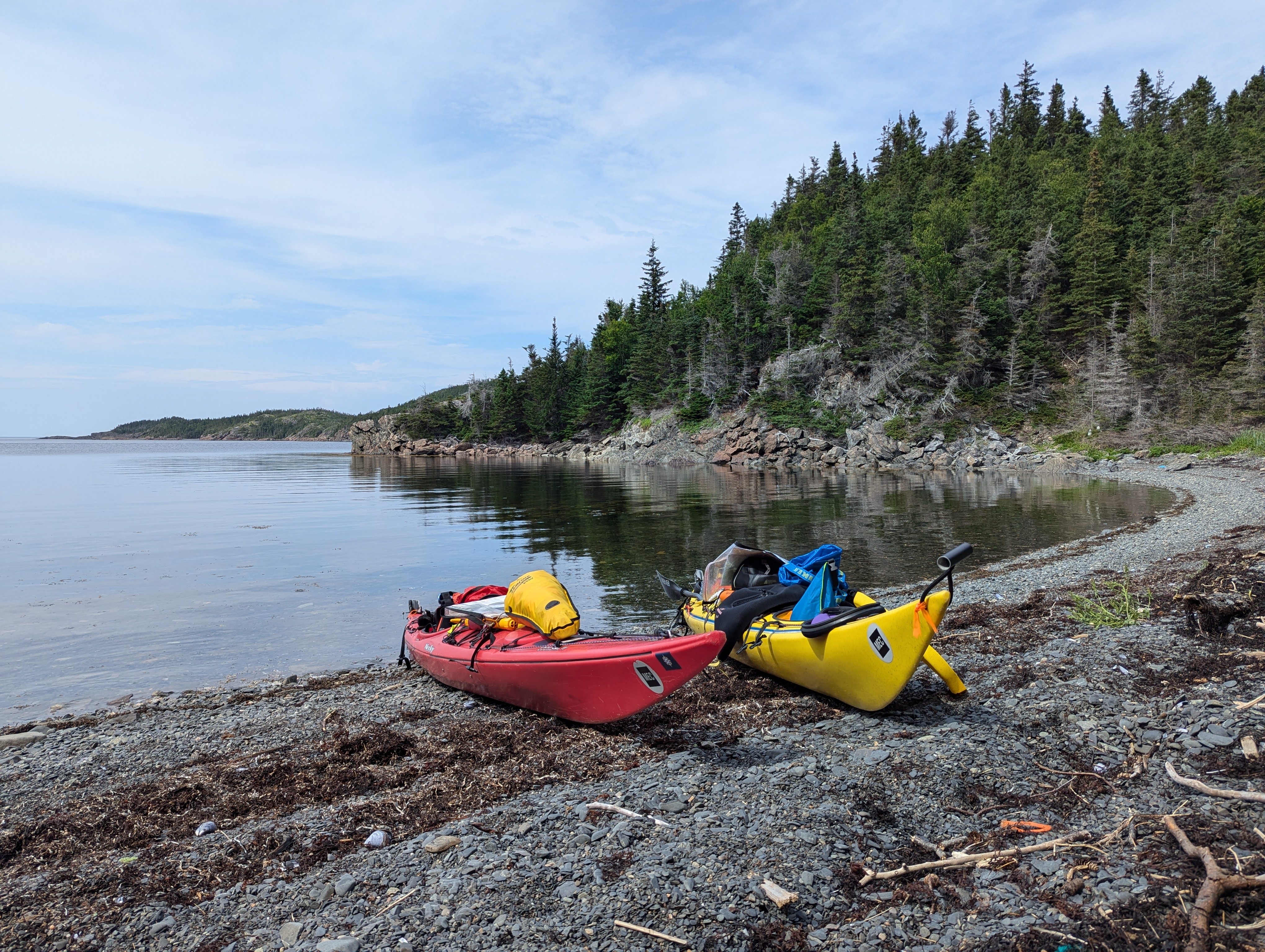
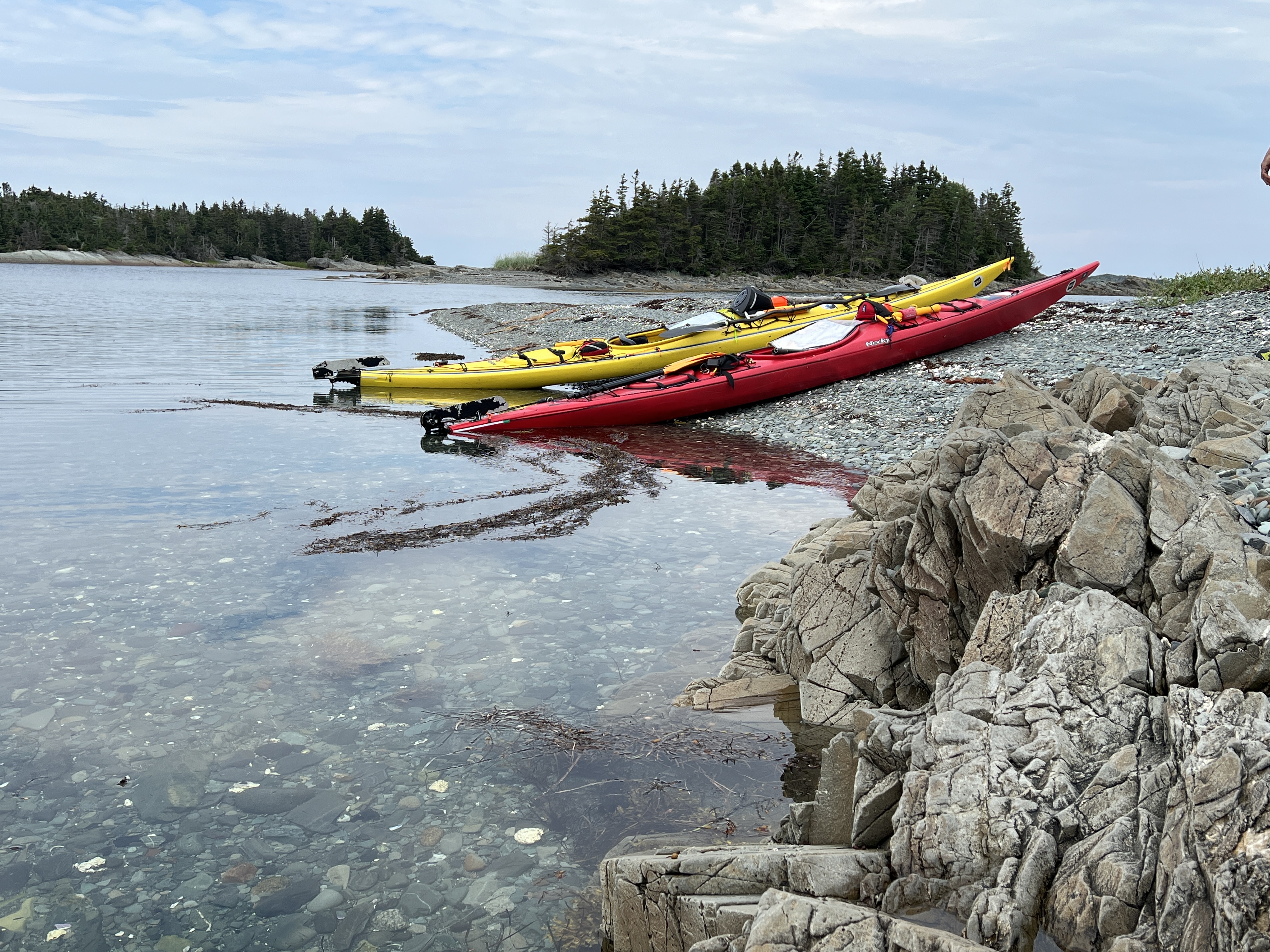
We left St. John’s on July 14 to drive to Twillingate. It’s about a five hour drive. Upon arrival, Deb and I drove around town looking for a good launch spot and we decided the small beach beside the Food Land fit the bill-easy access and close to the Tickle Bridge. Our expedition began the next day on July 15. Soon after launching, we crossed under our first many tickle bridges–this one connecting South Twullingate Island with North Twillingate Island. According to the dictionary of Newfoundland English, a tickle is “a narrow salt-water strait, as in an entrance to a harbour or between islands or other land masses, often difficult or treacherous to navigate because of narrowness, tides, etc; a ‘settlement’ adjoining such a passage.” These can also be called a reach or a run.
Day One-July 15: Twillingate to Moreton’s Harbour

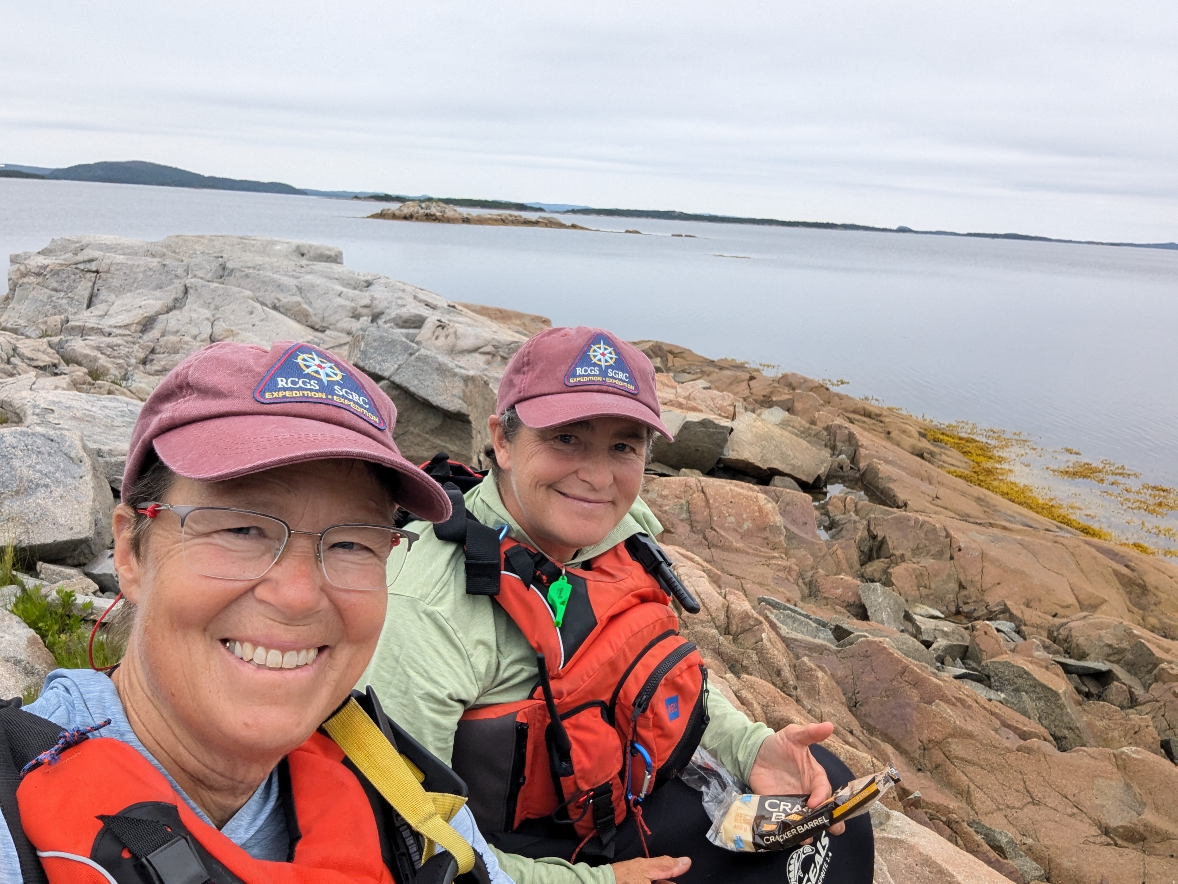
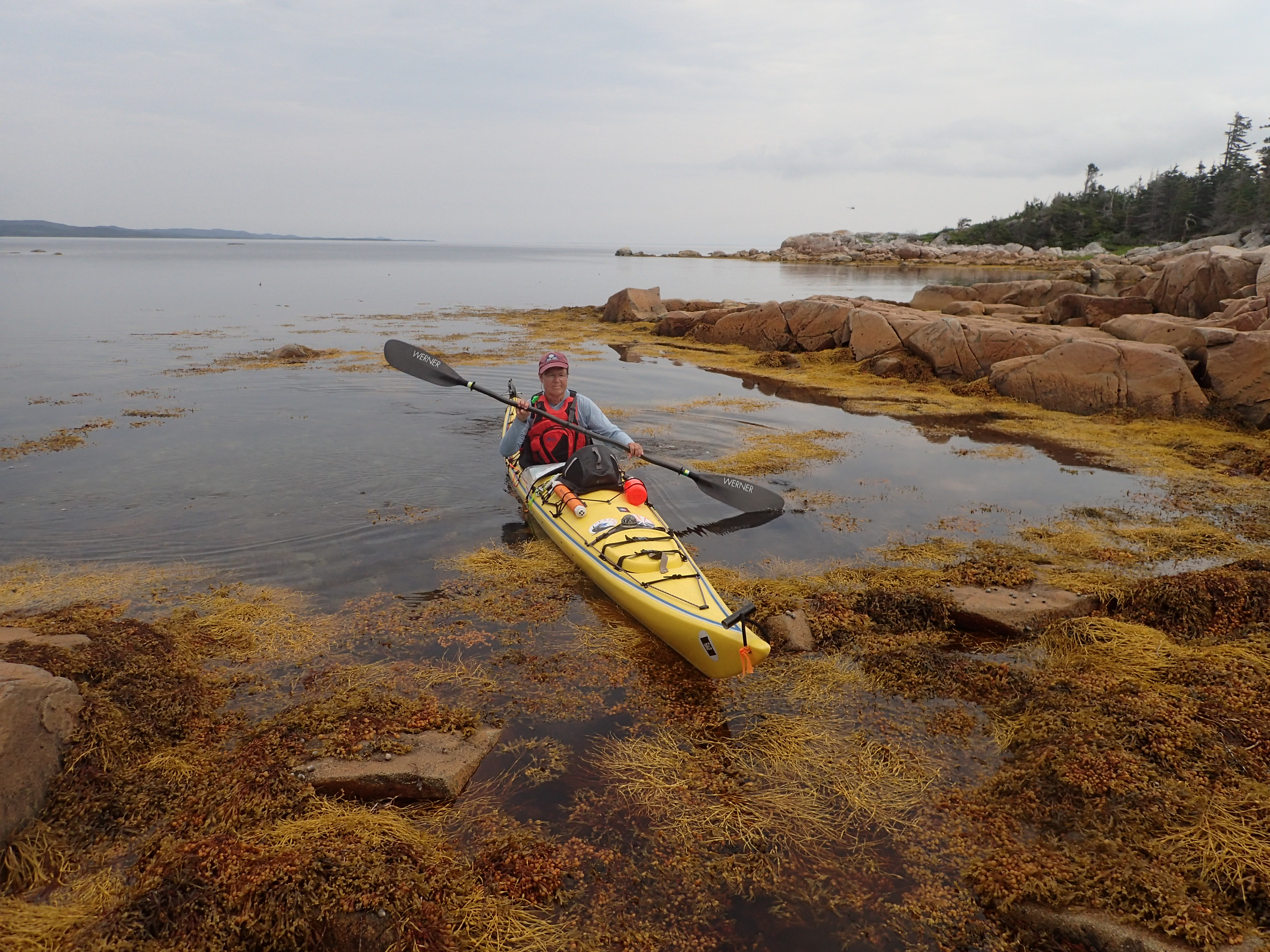
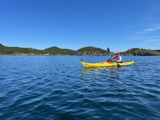
We were pretty nervous when we started out–we knew we had a big challenge in front of us–but we also knew we’d take it paddle stroke by paddle stroke, landmark by landmark, day by day. The goal for day one was to reach Moreton’s Harbour-approximately 13.5 kilometres away. Deb and Wilma saw us off and then captured us paddling under the bridge and out the tickle.
We waved one last time and paddled Southwest past Robins Cove, Rodney Cove, amd Bluff Head Cove. There, we began our 2 kilometre crossing to Matthews Island. The long Northeast fetch meant waves were hitting Matthews Island on the nose so we elected to keep paddling and we took aim for Toadasses Point (I have no idea why it is called that :-). From there, we went through the shallows next to Berry Island and took a short break on the beach. With our first crossing of the trip done, we relaxed some. Through the grey fog, we could just barely make out Baker Rock, our next landmark. At this point, we started to take the NE wind on our beam so we made slower progress than when it pushed us from behind. We paddled across Webber Bight and then Wild Bight. The sea state was more mixed now with clapotis since the waves were reflecting back off the headlands. We were quite happy to turn South and leave the choppier sea behind. We almost stopped in Beachy Cove but went onto Roses Harbour where I’d camped many years previous to see how it had changed.

Roses Harbour is the sweetest wee harbour with a gravel beach. There is one cabin in the cove and a trail that leads out the back towards Moreton’s Harbour. On a winded-off day on that long ago trip, we hiked into Moreton’;’s Harbour and had lunch at the now-closed library.

We concidered camping in Roses Harbour but decided we wanted to base our selves in Moreton’s Harbour for the night. After a snack, we paddled back out and made our way into the Back Harbour portion of town. At first, we weren’t sure if we’d get in because of low tide but it went, and we marvelled at how still the water was compared to much of what we’s already paddled.

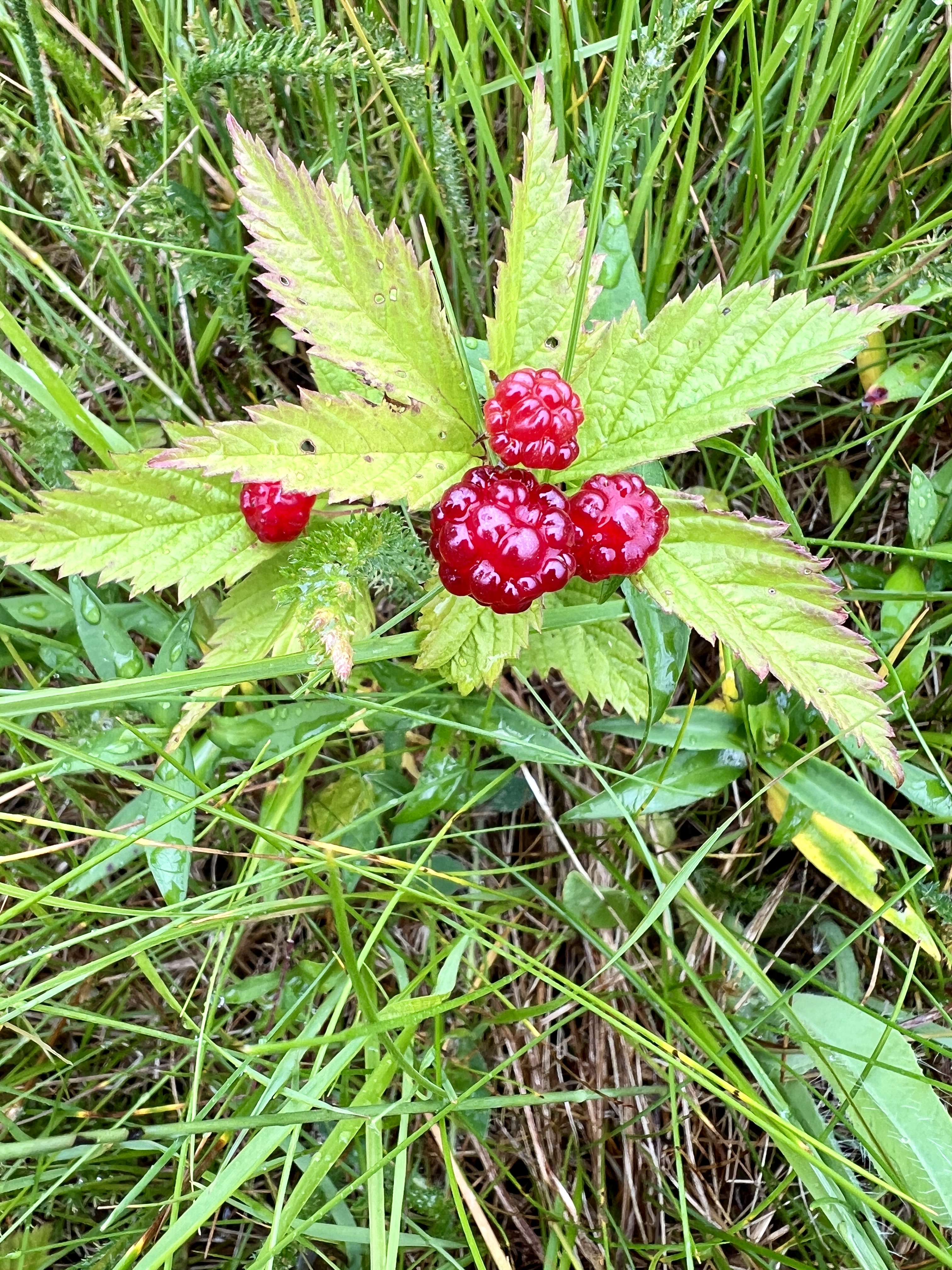
We spotted an old meadow and had a peak around and then paddled over to some nearby houses to ask if it was OK to camp. We talked to Winston and he said some other kayakers had camped there so it was likely fine. We set up camp and were thrilled to find our new home was flush with “Plum Boys,” known more officially as Rubus articus or Arctic Raspberry. There were a delicious treat and damp meadows are one of the favourite places to grow.
Our damp meadow was getting damper by the minute with rain shower after rain shower so we set up our rain fly and had some lunch. We stayed in our paddling clothes until the rain stopped a little later in the afternoon and all the luscious plants beagn to dry out and we thought it was safe to get into dry clothing and go on a bit of a wake-about.

We used an ATV track to get over to the main road and then followed it around the harbour. It was Monday mid afternoon so Moreton’s Harbour was pretty quiet. We picked up a weather report since there was cell coverage in town sitting beside the wharf.

The forecast predicted that some winds would pick up through the next day so we made a plan to get up at O-Dark O’clock to try to get our day’s paddle in before the wind got too much. With a plan in mind, we walked back to our campsite and had some dinner, celebrated out first day, and hit the hay (literally-the meadow was filled with very tall grass!).
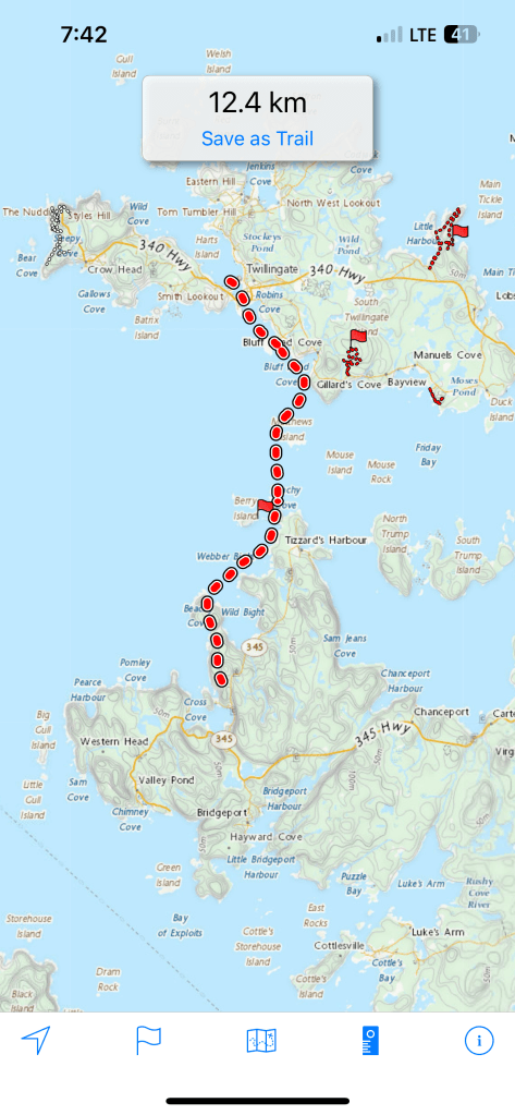
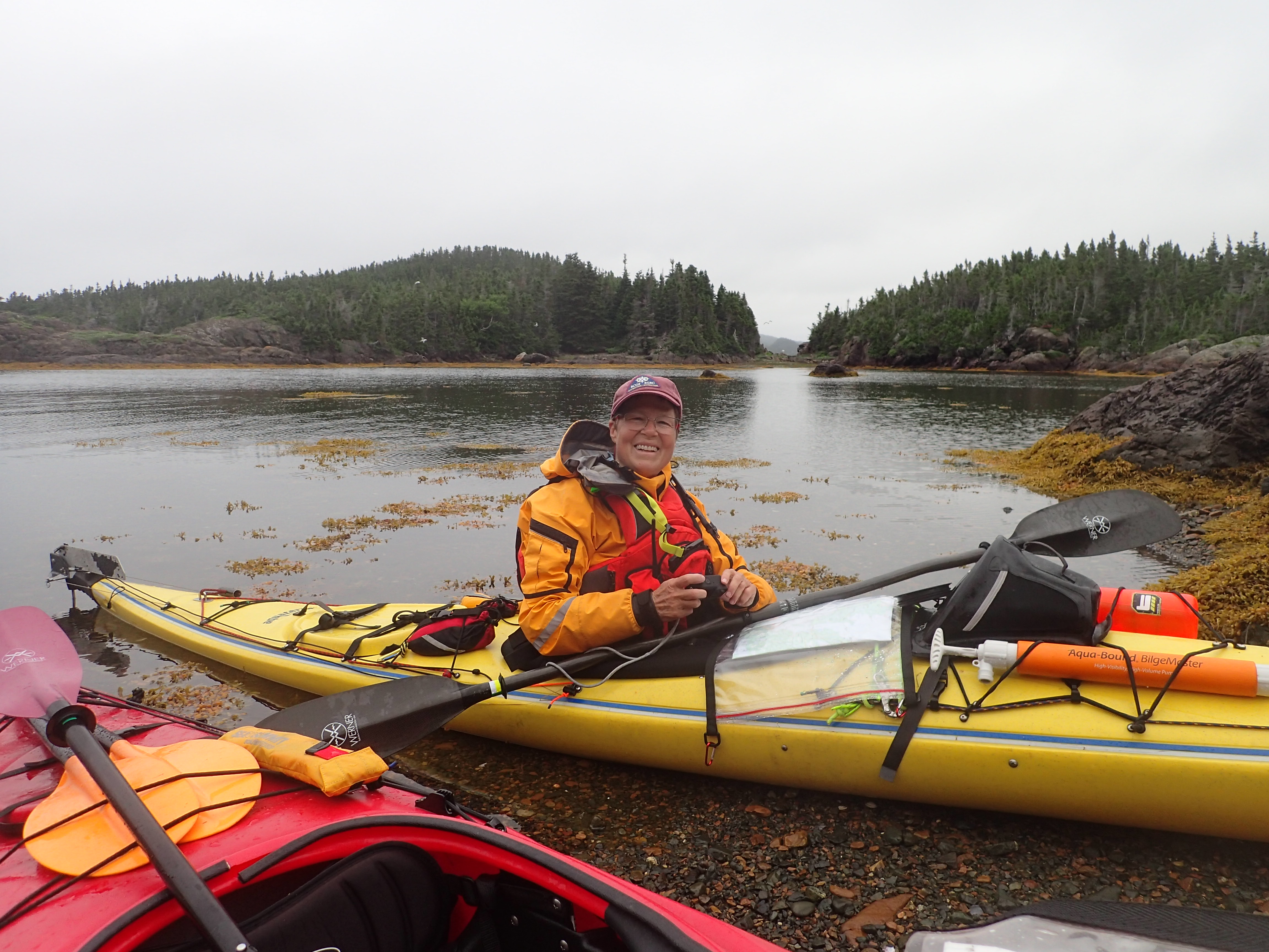
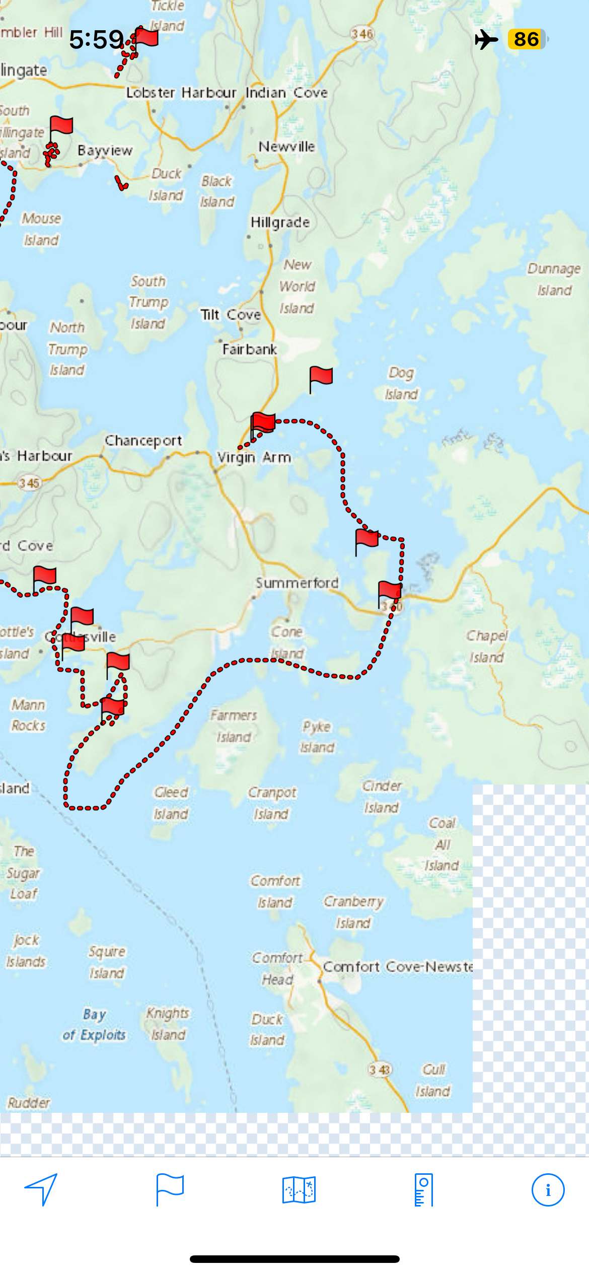
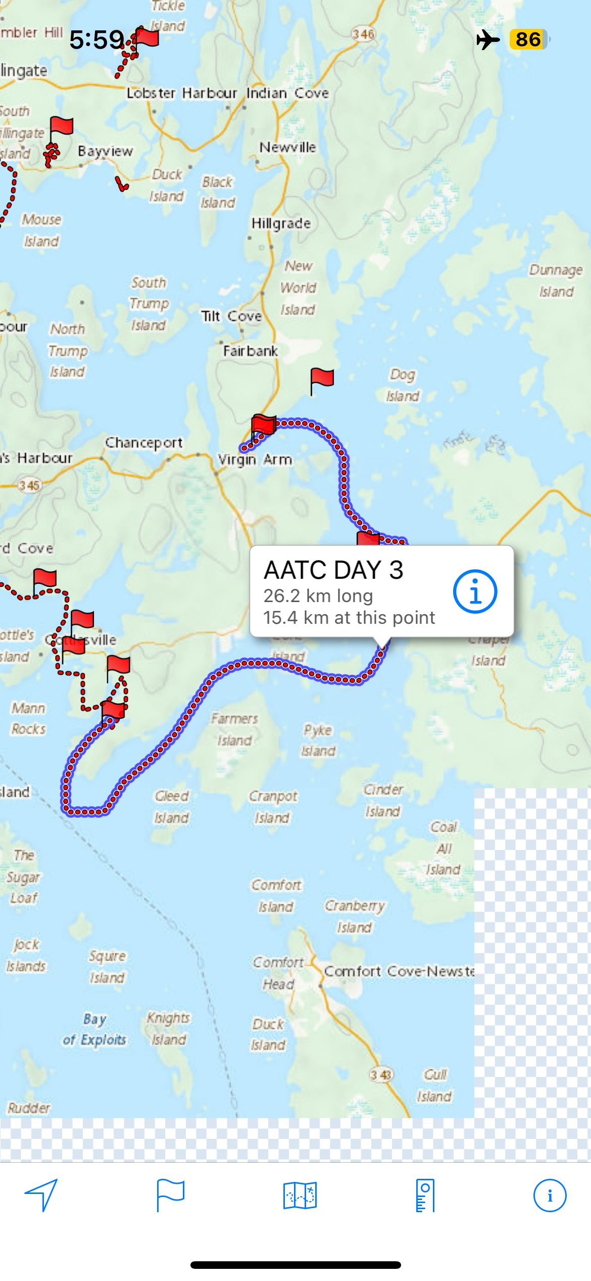
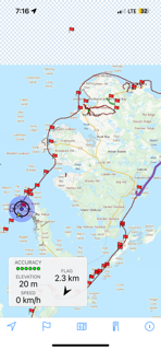
After each day’s paddle, I would use my finger to trace our approximate route for that day and take a screenshot. We didn’t feel like we had enough battery power to GPS track each day in its entirety but this gave us a sense of progress each day to watch our red circle grow incrementally each day. With the width of my finger and the smallness of the screen, it means all distances are approximate.
Day Two-July 16: Moreton’s Harbour to Intricate Harbour
When I woke Marian at 4:00 am, we realized that we might have had a bit of a miscommunication since it was still dark. Since I knew it would take us two hours to get out of camp on our first morning and since there was no way I was going to go back to sleep, I popped a few things into bags and headed out to face the swarm of mosquitoes that awaited outside the netting. I popped up my hood and swatted and swore and got the stove going. Breakfast was going to be the apt named dish, “Hasty Departure Pudding,” a new brekfast idea I got from my birthday book about trip food planning. Turns out, neither of us cared for the first rendition of it-nicknaming the dish Pasty Departure Pudding. As the trip progressed, I learned to make it with much more water than the recipe called for and it grew on on us!
It was a misty grey morning with a bit of foreboding on the side. We started paddling at 6 am and the water was significantly more calm than the previous day. It wasn’t long before we rounded Moreton’s Harbour Head and turned West towards the aptly named Western Head.

As we continued, we passed by Chockin Cove, Pearce Harbour, and the Baldney Rocks before the big turn around Western Head. We could see Big and Little Gull Islands and noted that we could have pulled off in Western Head Cove and Sam’s Cove if needed. The shoreline was relatively steep with interesting landmarks along the way like Manifold Rock, Chimney Cove, and Dicky Head which marked another turn back to paddling East. We knew we’d soon be in Valley Pond. Neither of us had been to Valley Pond before and as we paddled in, we were struck by the combination of old and new. Older grey fishing premises marked the beginning of the community.
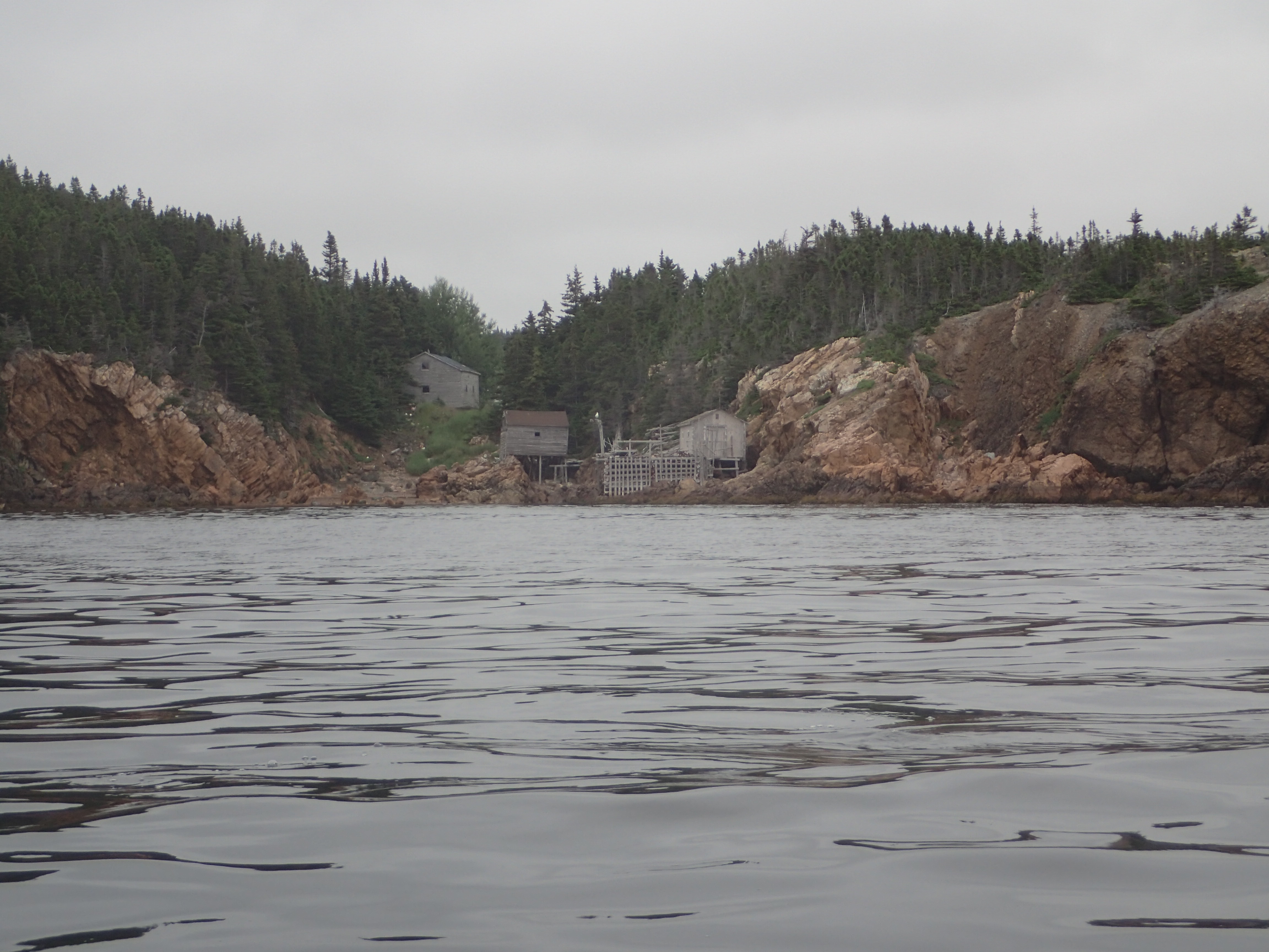
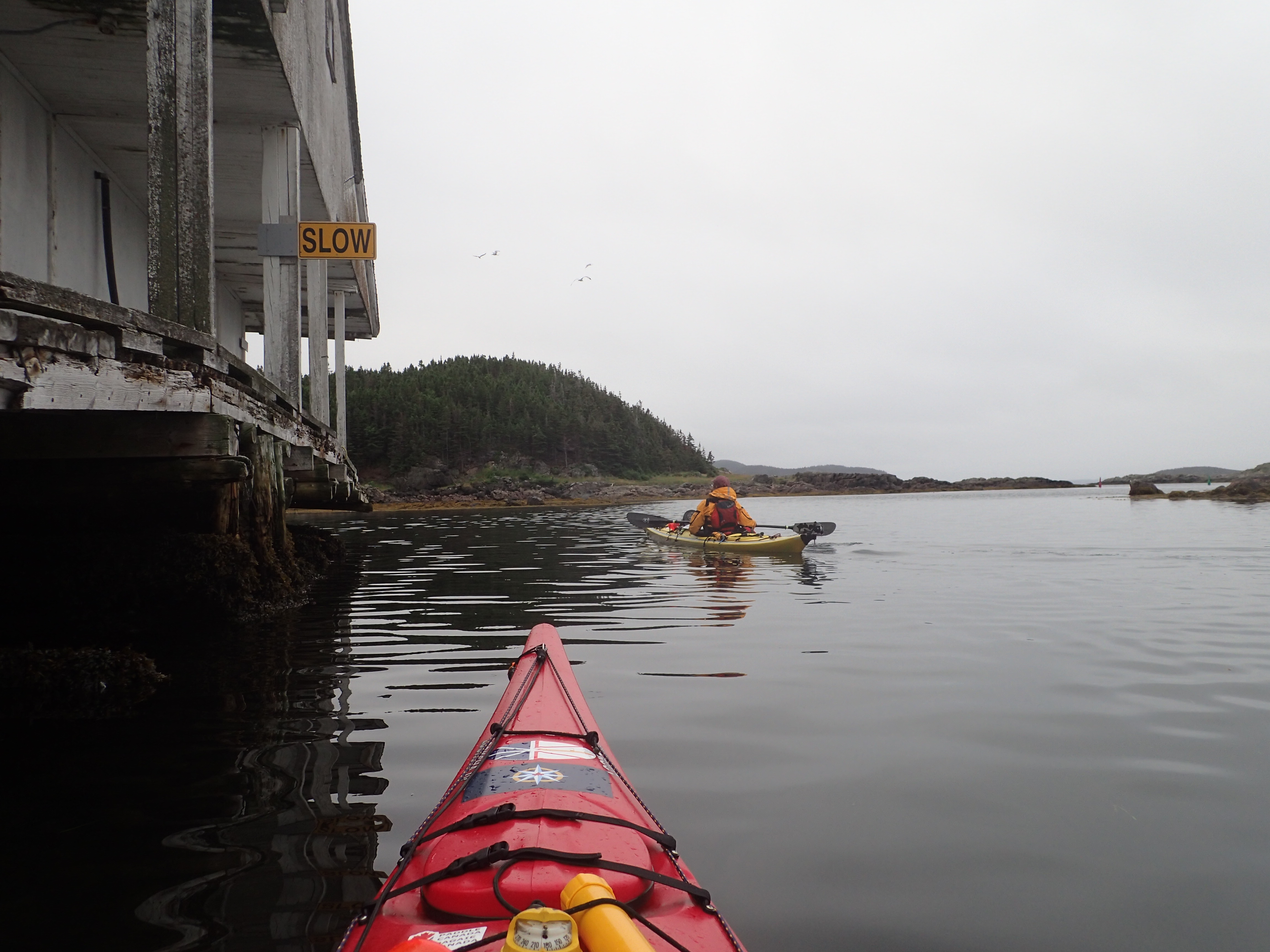
The main part of the community ringed a saltwater pond which provided a sheltered harbour. We waved to a few folks and we paddled in. A building on the shore which appeared to be a former fish processing plant looked like it had seen better days but had a fun sign that we decided was out trip motto, “Slow.”
We had decided to build our distance slowly to avoid agrevating any of our various muscloskeletal injuries. It had been a good thought but already later this same day, we paddled further than intended to reach an anticipated destination. After our jaunt about town, we contiued Southeast heading towards Bear Gulch. We didn’t see any bears but soon after took a beach break and had a snack.
Refreshed we paddled towards Bridgeport Harbour Head and made another turn to the Northeast. The sky was deep grey and we thought it might get hammered by rain but it just kept being moody.
We decided to keep Bridgeport for another time and crossed Southeast across the mouth of Bridgeport Harbout and set out for Puzzle Harbour Head. Knowing that many Newfoundland and Labrador landmarks are named for a reason, we wondered what Puzzle Harbour and Bay had in store for us. The sky lightened and actually turned blue as the day progressed. Once we arrived in Puzzle Bay, we realized the name was very apt as we stopped to mull over the land in front of us. We looked over our maps carefully as it was challenging to discern the opening behind Cottlesville Island we were wanting to paddle through. There were several islands hiding the entrance to Luke’s Arm but eventually we pieces the puzzle together and paddled into the tickle that would lead us to Cottlesville and lunch! We stopped on a small island just in front of Cottlesville and took a great break from the boats.

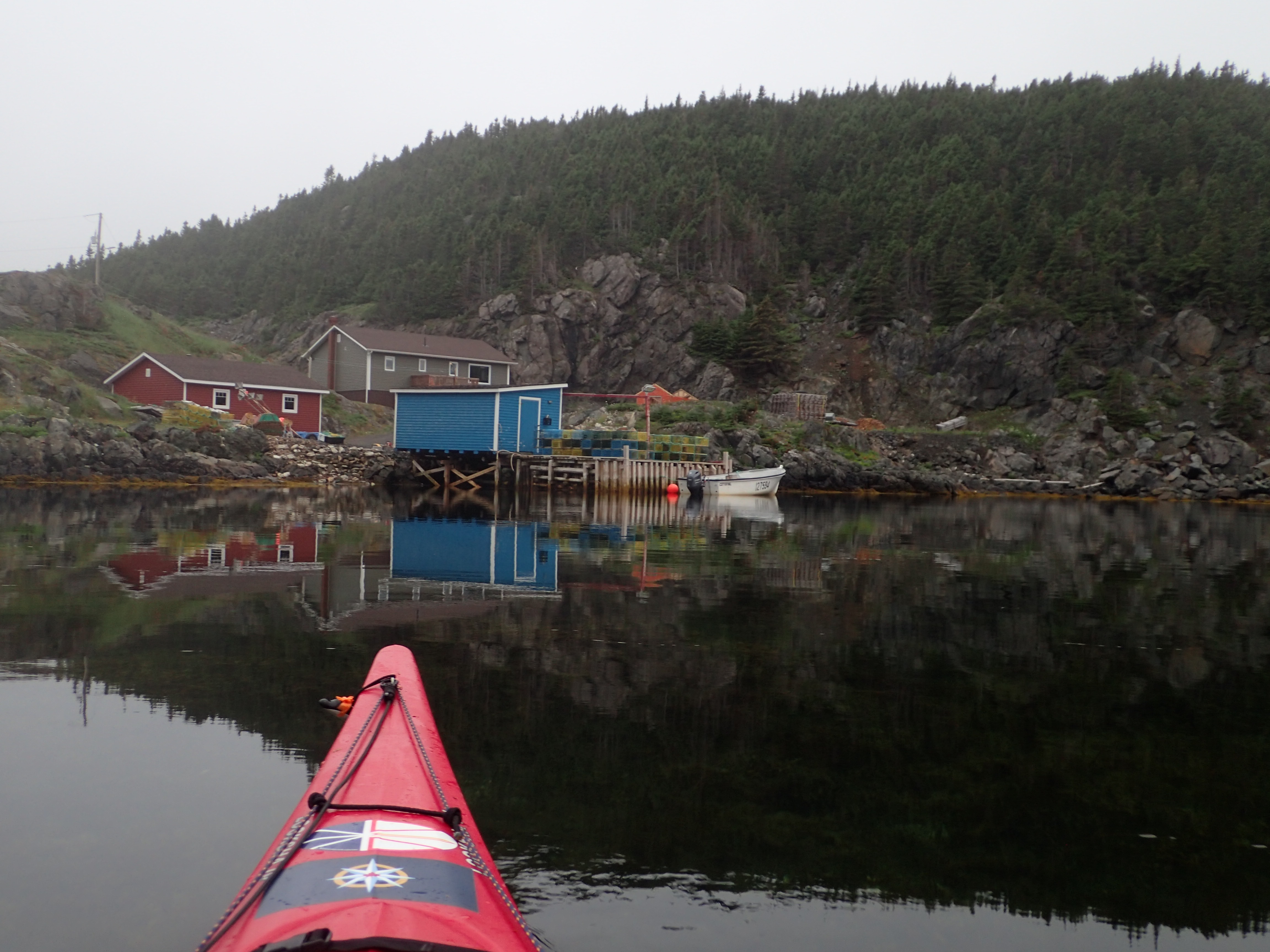
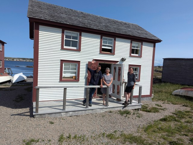
During lunch, we realized that Intricate Harbour was in reach and so made the goal to paddle there for the night. We knew that Lindy Rideout had built a lodge in the back of Intricate Harbour so we thought we might drop in and say hello. I had never met Lindy but knew he was a legend in the NL sea kayaking scene-having guided kayakers in the Dildo Run area for decades as well as founding Sea Knife Kayaks where he built fibreglass kayaks for the NL (and beyond). Though he was welcoming a new group of guests, Lindy took the time to share some beta about the tidal current under the Curtis Causeway and paddling conditions in the Dildo Run. Lindy also filled our freshwater bags and let us know his favourite camping spot in Intricate Harbour. We also were able to pick up a weather forecast using his wifi.
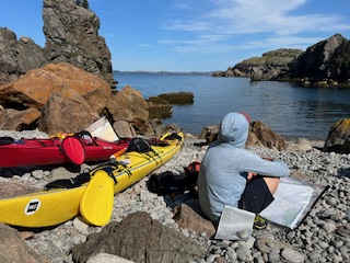
The afternoon turned hot and we paddled back out to Lindy’s recommendation of Garden Cove. He told us that in Garden Cove there were three meadows cut by three brothers for their gardens because they didn’t get along. As we paddled in, we could indeed see the remnants of three meadows on each aspect of the cove. After a look at one, we chose Lindy’s favourite as it likely has the best breeze and we knew it would be buggy!
Given the rain and dampness of Moreton’s Harbour, we held a yard sale to get all of our gear and clothes dry. The newfound dryness didn’t last all that long as that evening, we had a big thunderstorm that returned the moisture to us but fortunately cooled off the evening and made sleeping a possibility.

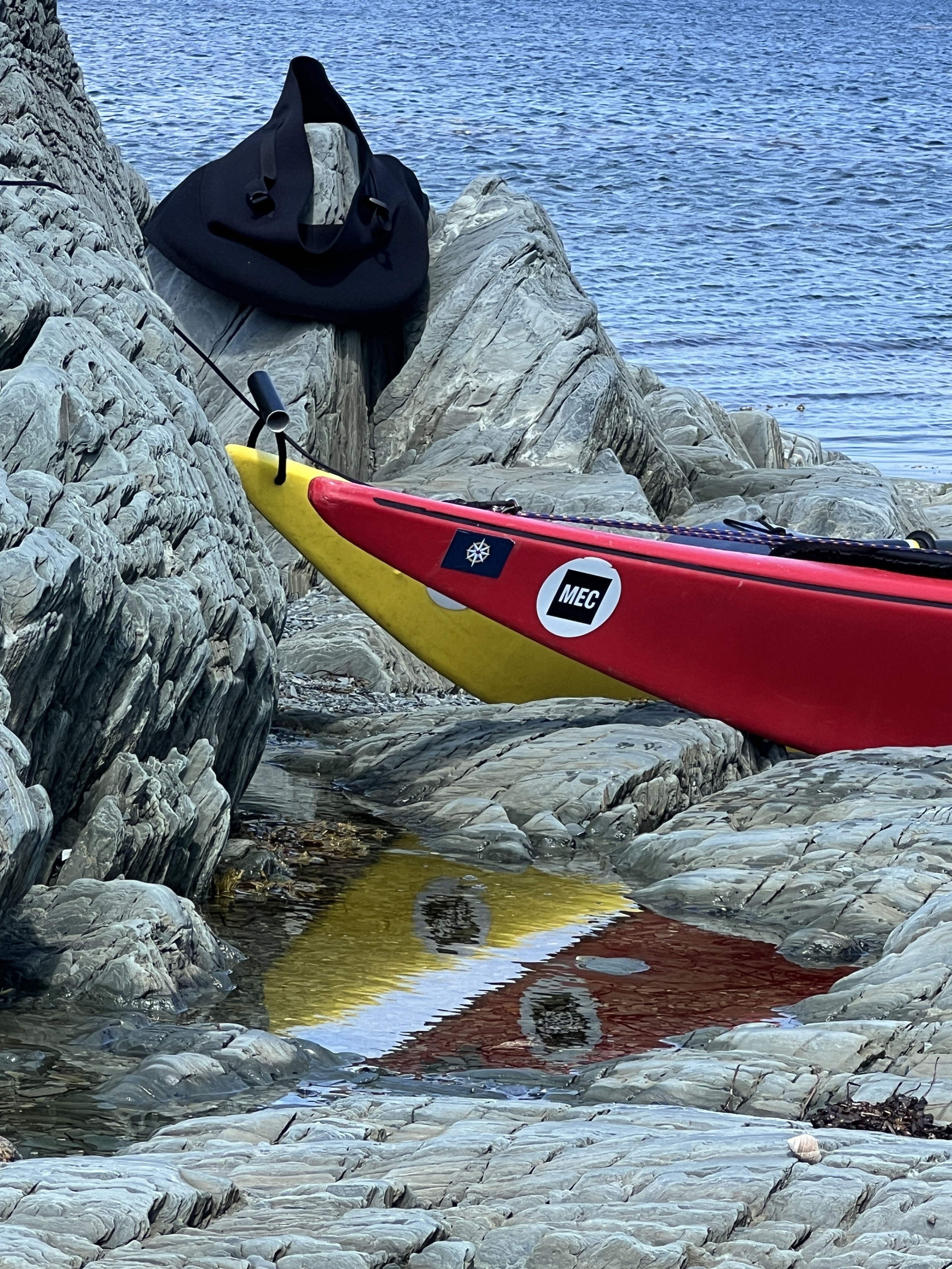
As we enjoyed dinner we noticed what looked like a rock in “our” harbour. This turned out to be a very curious seal, we nicknamed Babette. It keep it’s head about water for 45 minutes or so (I’d never seen a seal do that for so long) and we figured that we must have picked Babette’s favourite beach as well. If you look carefully in the picture below near tje left point, you will see a dark round rock looking item-that is Babette.

We figured and refigured the tide and the calculated how long it would take to get to the Curtis Causeway and decided we needed another early start-though an hour later-give give some light to the sky. We tucked into the tent just as the cumulonimbus cloud was blowing our way and the first thunder cracked. After a big deluge, I popped out to check the boats and then had a grand sleep after a big day out.


Day Three-July 17: Intricate Harbour to Dildo Run Provincial Park

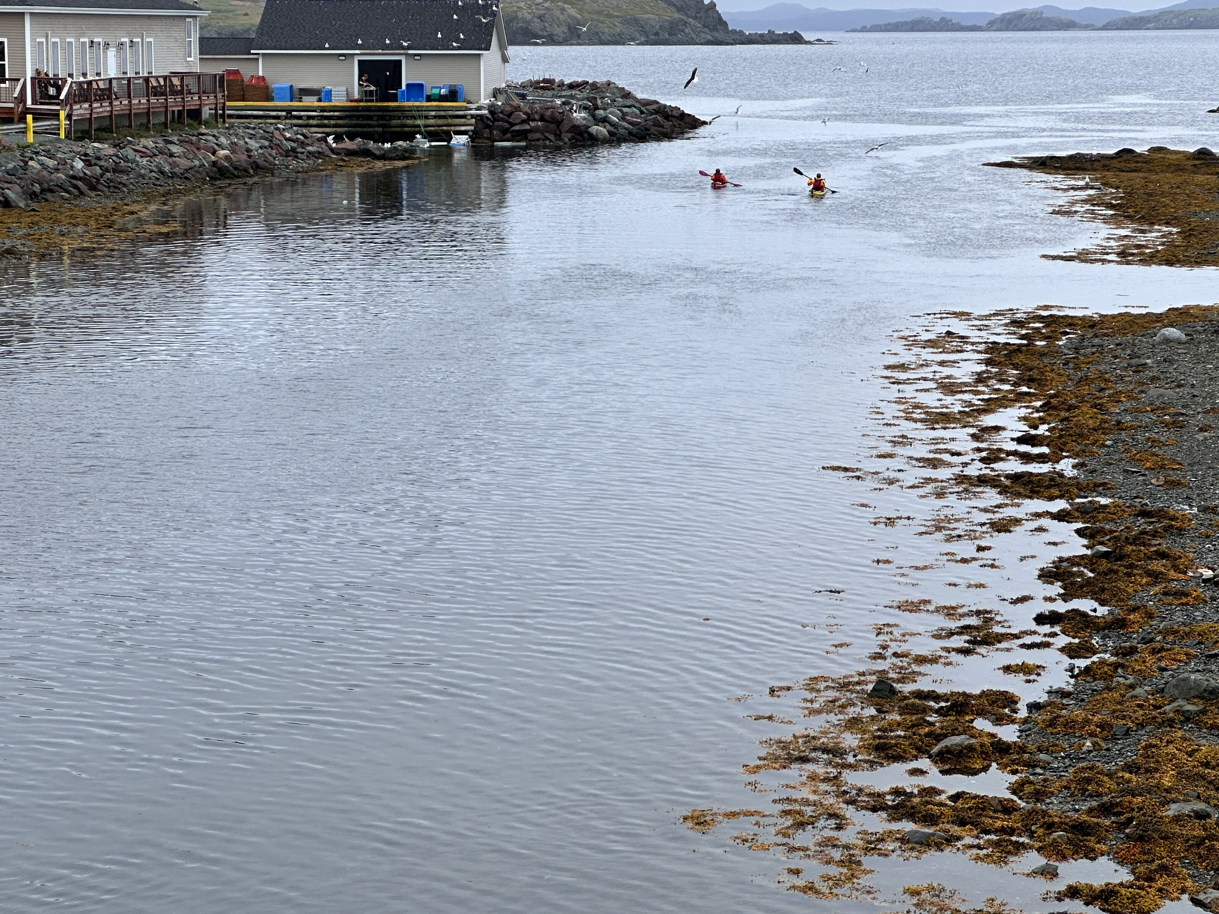
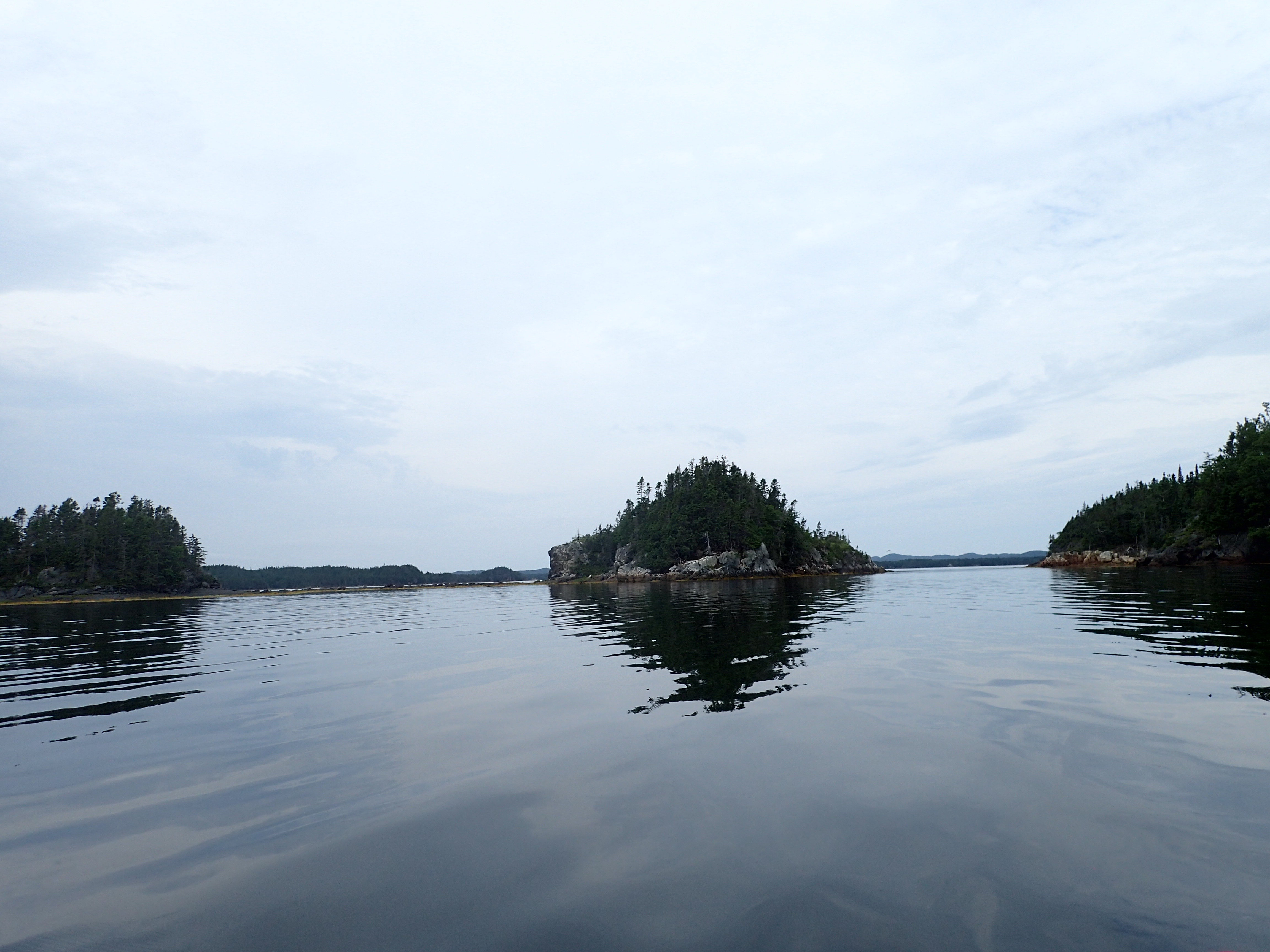
This day dawned still and Babette was nowhere to be seen. As usual, the mosquitoes joined me for breakfast prep. We packed up and headed out knowing we were on a mission to get to the Curtis Causeway at a good time (though Lindy had told ous of a sneak route that only involved unloading the boats and carrying them over the highway and reloading them-high motivation to get there in time). The waters stayed reflective calm all day with the islets of the Dildo Run beginning to appear like salt and pepper on a gourmet meal.
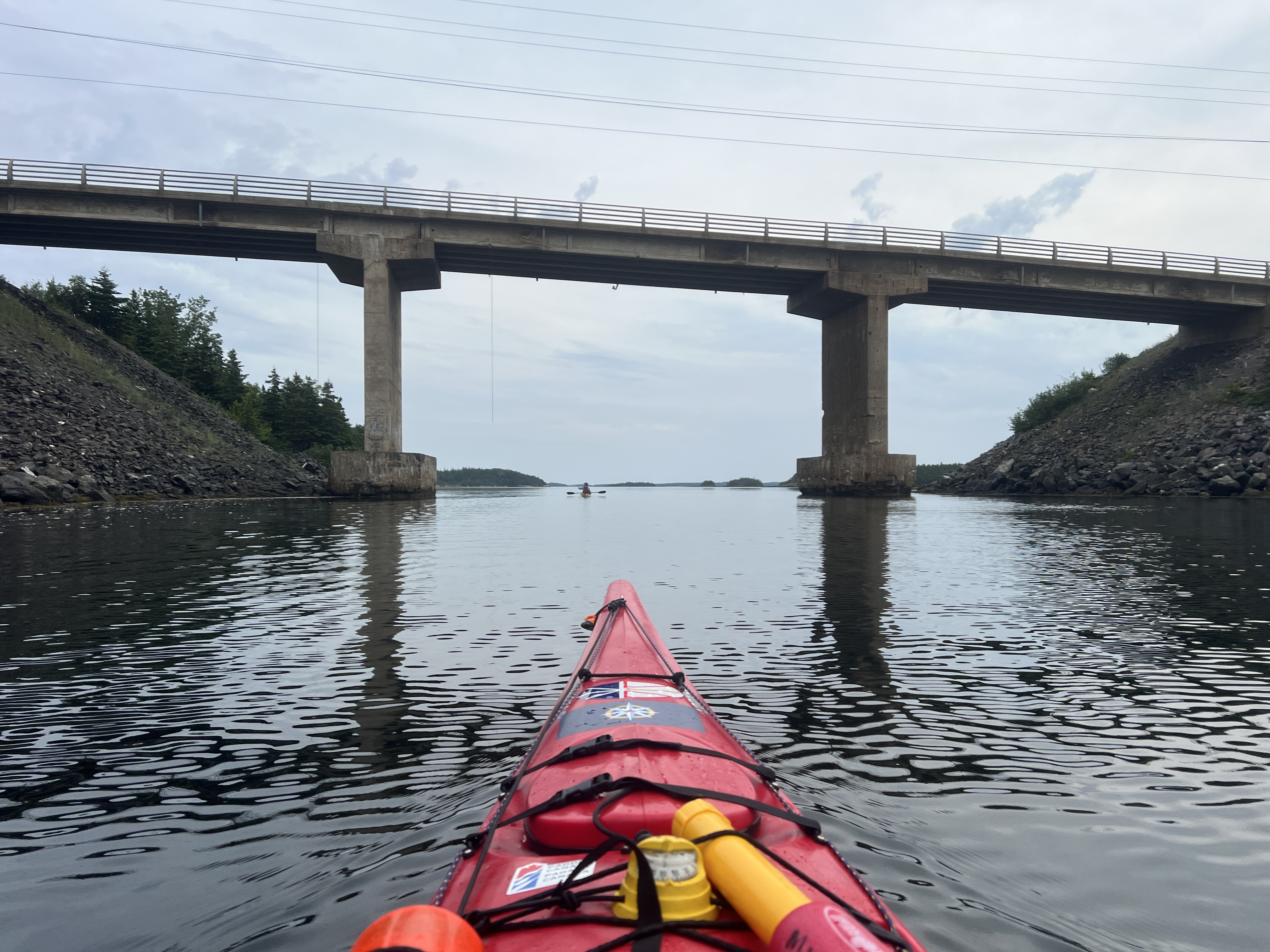
Soon enough, we were on approach to our second tickle bridge of the trip, the Curtis Causeway. Watching the water begin to show current…in the direction we needed to go, was an awesome feeling! Lindy has mentioned at peak tides there could be whirpools and very strong water but we were treated to a placid transit and a few cars even honked as they went over us. The highway route to Twillingate is called the “Road to the Isles,” because there are several islands that are now connected by the road. In earlier times, there were smaller ferries that provided passage but now a series of bridges and causeways make the trip very efficient.
After passing under the bridge, we had to start making our way over the the provincial park through more islands and islets…but we also needed some lunch. We learned that my navigational skills go down in direct correlation to my hunger level going up so we found a lovely beach to stop and add some calories.
With some food in, the map started to make sense to me again and we enjoyed a stellar paddle with still like a mirror sea.
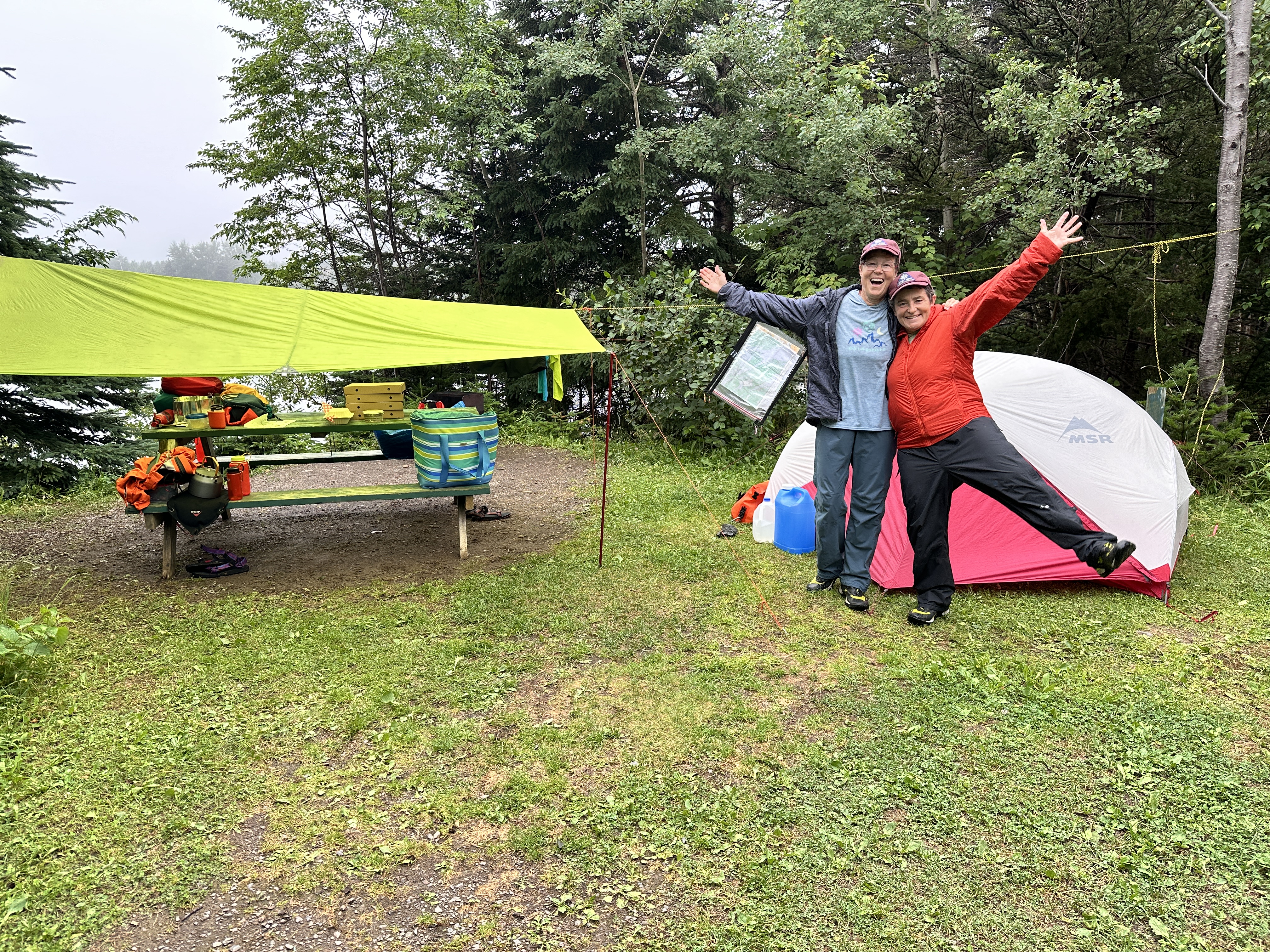
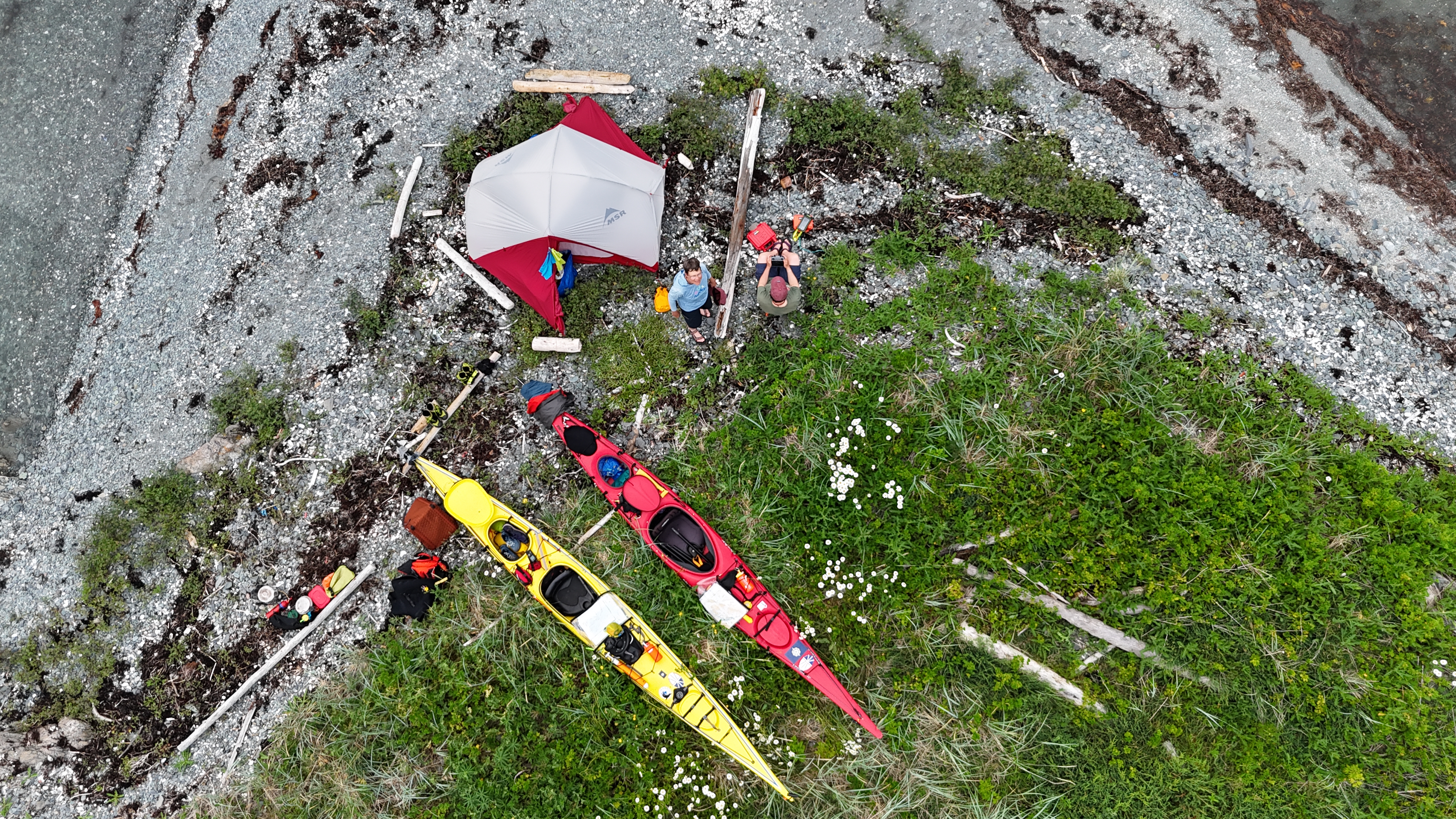
After arriving at the provincial park and discovering that Site 10 was an excellent place for kayakers to camp, we got the tent up just in town for the skies open and the rain fell in sheets. Alreasy wet, we decided it was a great time to walk to the shower and get cleaned up. Our friends, Deb and Wilma delivered dinner a few hours later-pizza and beer-to take the place of the “Puppy Chow” (Wilma’s code name for our dried fare) and indeed it was delicious. They also delivered next 10 days of our food rations that would take us through to the end of our paddle. After much storytelling, they returned to Twillingate and us to bed to be ready for another early start.

Day Four-July 18: Dildo Run Provincial Park to Port Albert Peninsula
It was a calm, mauzy morning when began paddling. We wondered what navigating through the Dildo Run would be like with reduced visibility so we set up several waypoints that we could check as we made our way to the start of the Goose Tickle between Dunnage and Chapel Islands. The wind was still and the water like glass.
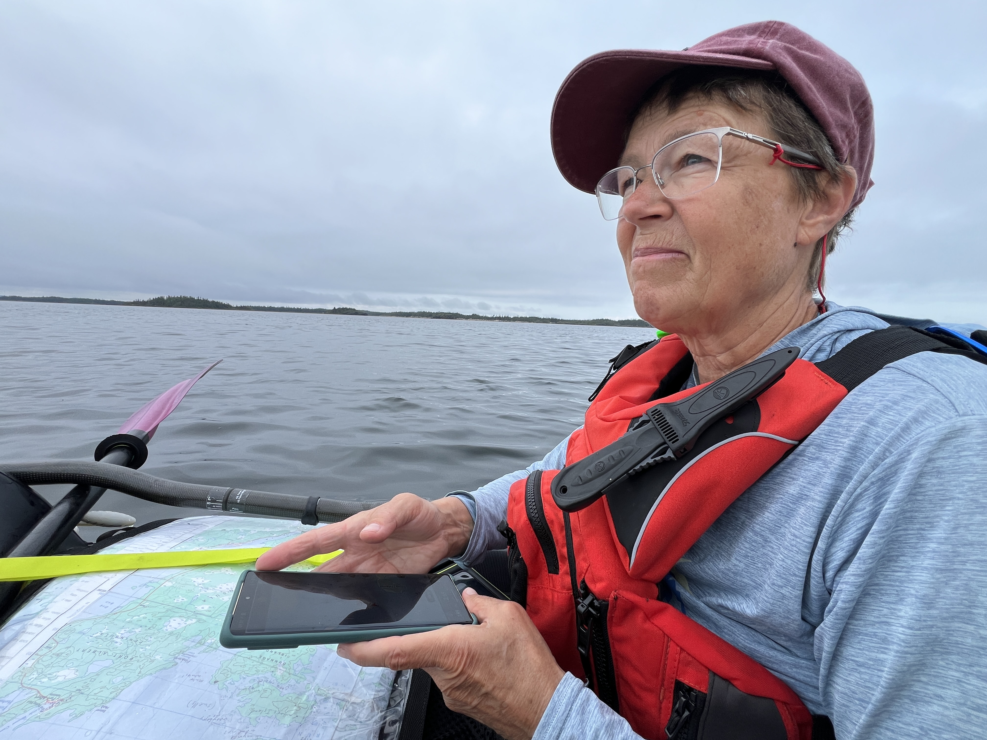
Many of the islets looked the same so frequent stops to check our progress became the norm. We’d spot to occasional channel marker and we were glad to have both the topo map and the marine chart as well as our phone GPS to use to make our navigation decisions.
Once we entered the Goose Tickle, we met the kayakers we’d seen the previous day and chatted about our respective trips. They invited us to stop for tea but we knew the tide was dropping so we continued on–good thing too–as we have a lovely current send us through the tickle. The mid point was shallow and nearing the point where we might have had to do a carry-over if we’d been there with less water, so that was a good call. Working up an appetite, we stopped at the end of Dunnage Island to check out a potential campsite we’d marked on our maps and have lunch.
The camping wasn’t great but lunch was delicious! We enjoyed the view out towards Change and Fogo Islands as we ate and plotted our crossing across to Beaver Cove. The crossing was uneventful and we continued up the peninsula until we were surprised to see an unexpected mammal on the shore-three of them in fact. At first we thought they might be moose, then caribou…but they turned out to be cows that had made their way over from the other side of the peninsula near Farewell where there are some community pastures. Dunnage Island is considered to be the boundary between the Central and Avalon platforms so as we continued paddling, we passed by the town of Port Albert and some amazing geology along the way-not to mention the rose bush showing off!

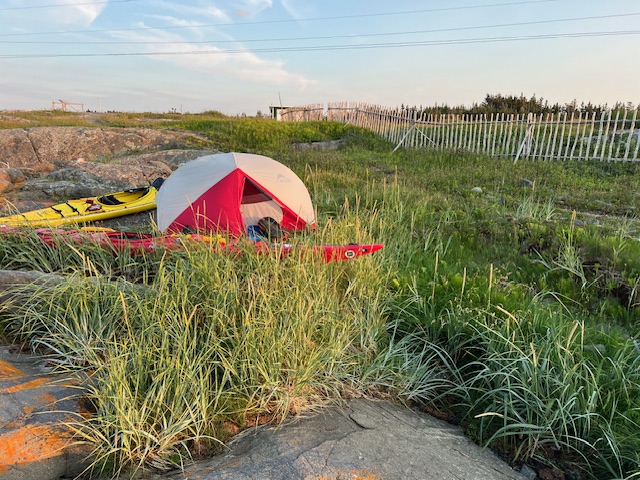
We thought we might go all the way to the top of the peninsula but then we spotted a small salt water pong with a lovely point to camp on so we stopped for the day-little did we know that the ferry terminal was directly opposite so we could hear the ship’s horn blow for every departure!
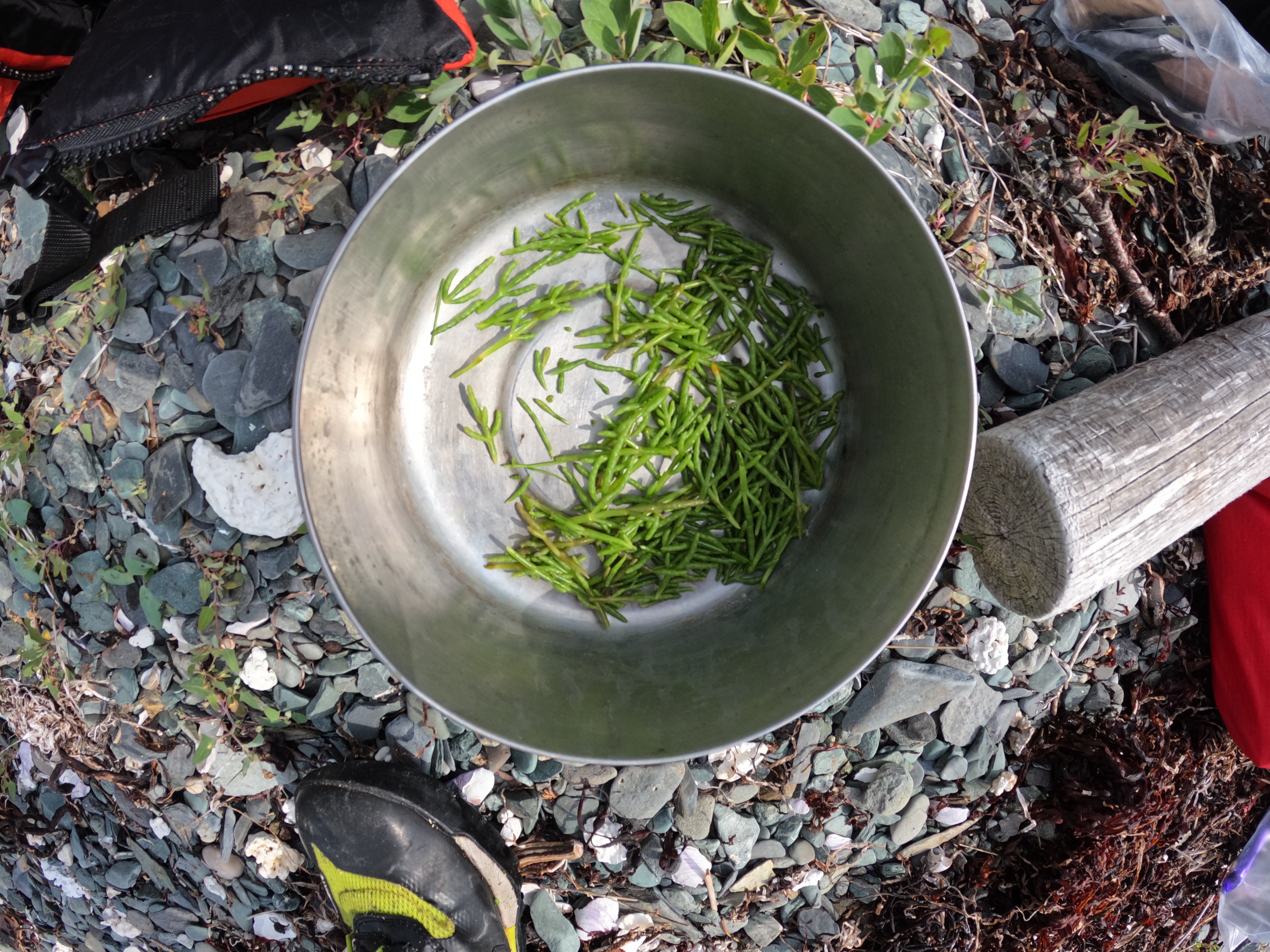
This campsite ended up being our favourite of the entire trip because it had many wild edibles such as gooseberries, samphire greens, and lovage to ennjoy! We waited until high tide to pitch our tent because we wanted to ensure that the spot we’d chosen would stay dry.
After tucking into some samphire greens with our miso soup, we enjoyed some Super KD and a Quidi Vidi Day Boil that our friends had brought us. We used our drone to capture our beautiful surroundings.


After dinner, we did our preparations for our big crossing to Fogo Island the next day. We went to bed early but, between our nervousness about the crossing and the small waves (that sounded huge from within the tent) hitting our small point, we were a bit restless that night.

Day Five-July 19: Port Albert Peninsula to Little Seldom, Fogo Island
We made it to Fogo Island and we paddled here! This was one of the big moments we hoped for on this trip but of course, was highly weather dependent. We had an early start so we could cross the Fogo ferry service corridor before the first ferry left. We got there at a perfect time and 20 minutes of dedicated paddling had our out of the way of the big ferries.

We crossed to the middle of the Dog Islands group and then made way to Burnt/ Handy Harbour Island. We climbed to the highest point (no surprise there) and got a look at the rest of our crossing. Conditions looked good so after a snack, we set off in the direction of the Western Indian Island.

After a hardy chat with a Stephen Bown from Fredericton, NL who was at his cabin-he was a bit surprised to see kayakers. He’s a gardener so we lamented meadow voles and slugs. After lunch, we began our crossing of the Stag Harbour Tickle. With a bit of SW wind pushing us, we were over in no time so much do that we decided to continue down the coast to Little Seldom.
That same breeze that got us here made cooking a challenge so I got inventive with beach finds to cook dinner. After dinner, after Fraser Carpenter let folks in Little Seldom know we were here. Brandon Collins came down for a visit and brought us a treat.

We had a grand yarn about much. I was really interested to learn about Brandon’s vocation as a fish processor. I learned about the long hours of work required during the fishing season. I thought how some of the lyrics of I’s the B’y focus on the importance of getting the fish. We’ve seen many folks out participating in the recreational food fishery on our route and knowing that all fish caught need to be processed.
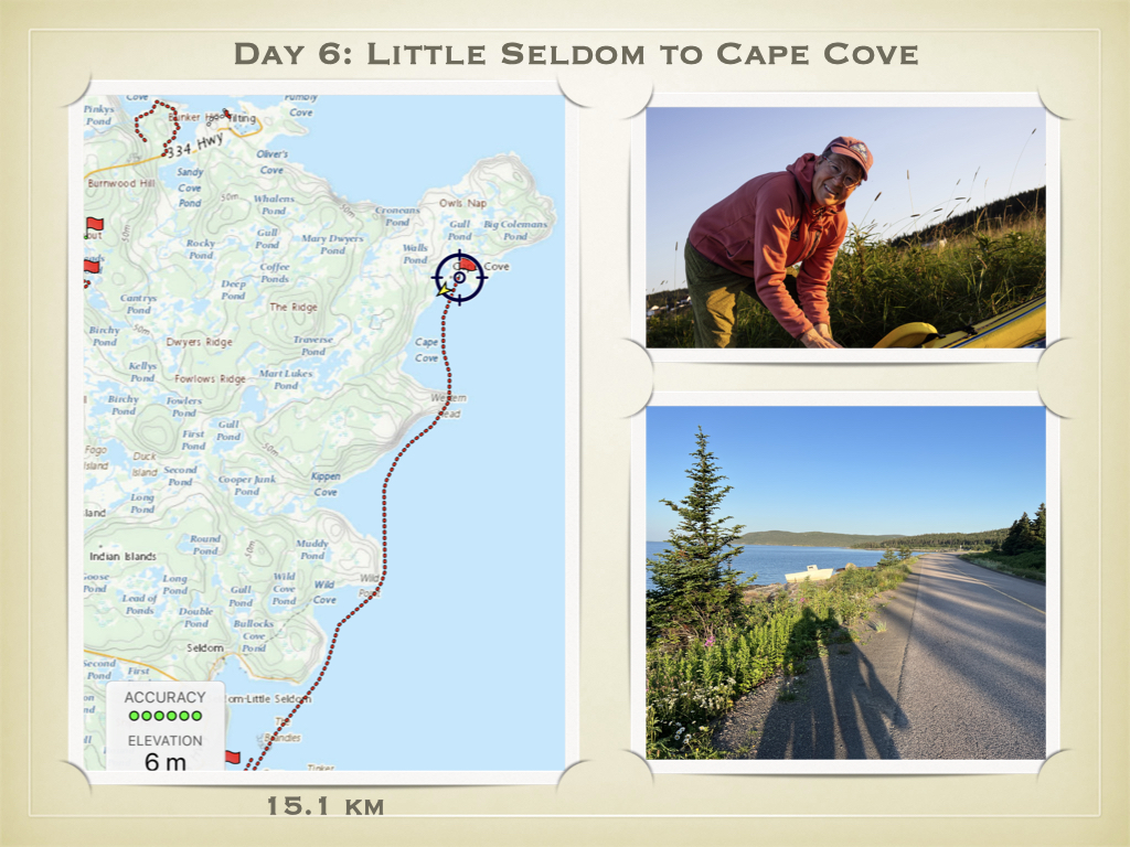
Day Six-July 20 : The Quiet of the Cove
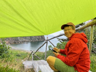
I’m sitting under our rain tarp hiding from the sun in Cape Cove. We decided the weather was favourable for going around this formidable head at the corner of Fogo Island with a stiff breeze from the Southeast. We had some great location advice to wait for the wind shift to west tomorrow. Since my Garmin InReach subscription is having commitment issues,
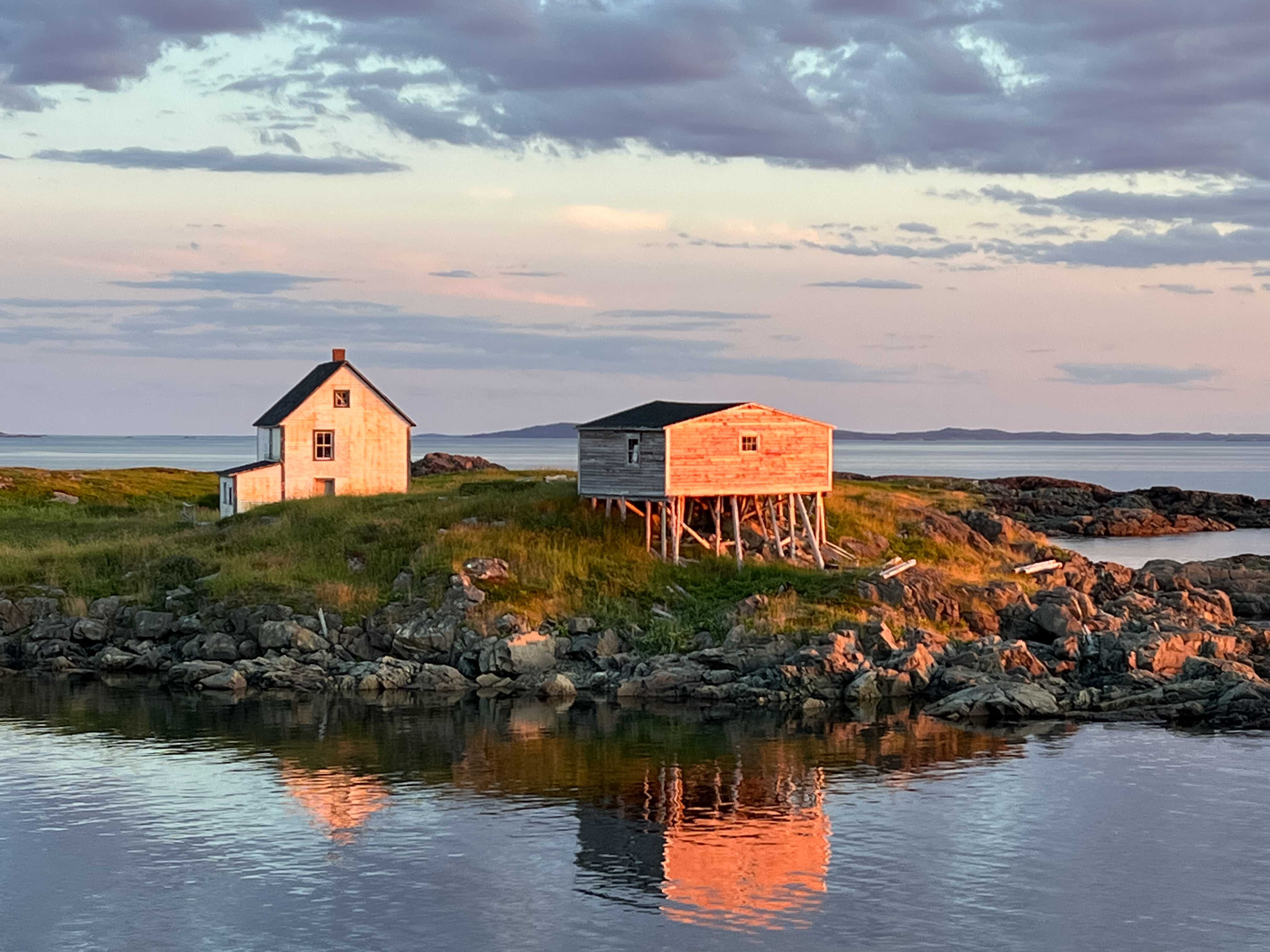
Where we really are…is in the quiet of the cove…Wayne Chaulk, one of NL’s famous songwriters, wrote a much beloved song called “Saltwater Joys,” that celebrates some of the many pleasures of outport life in NL. From the cleared fields, graveyard, and cabins in this cove, it’s obvious that folks used to live here-growing root crops, catching fish, foraging berries, and cutting wood.

We watched across the bay as folks came in to visit a cabin-perhaps having a feed of cod they jigged this morning on their way here. We waved to each other but didn’t speak. Once we decided to stay put, we had some lunch and went on a hike towards Cape Fogo Head.
The cliff edge was easy walking, the sky blue, and the breeze helped keep the stouts at bay. Along the way, we lucked into a few ripe patches of bakeapple (called a cloudberry elsewhere). Bakeapples grow one berry per plant and bakespple patches are closely guarded family secrets.

We had such a lovely start to our day. Carol Warren picked us up and took us to her home in Stag Harbour for a delightful breakfast that kept us fuelled until we landed on the beach here in Cape Cove. Her generosity in proving breakfast, charging our battery packs, and filling our water bags was much appreciated! Thanks Carol for your kindness.
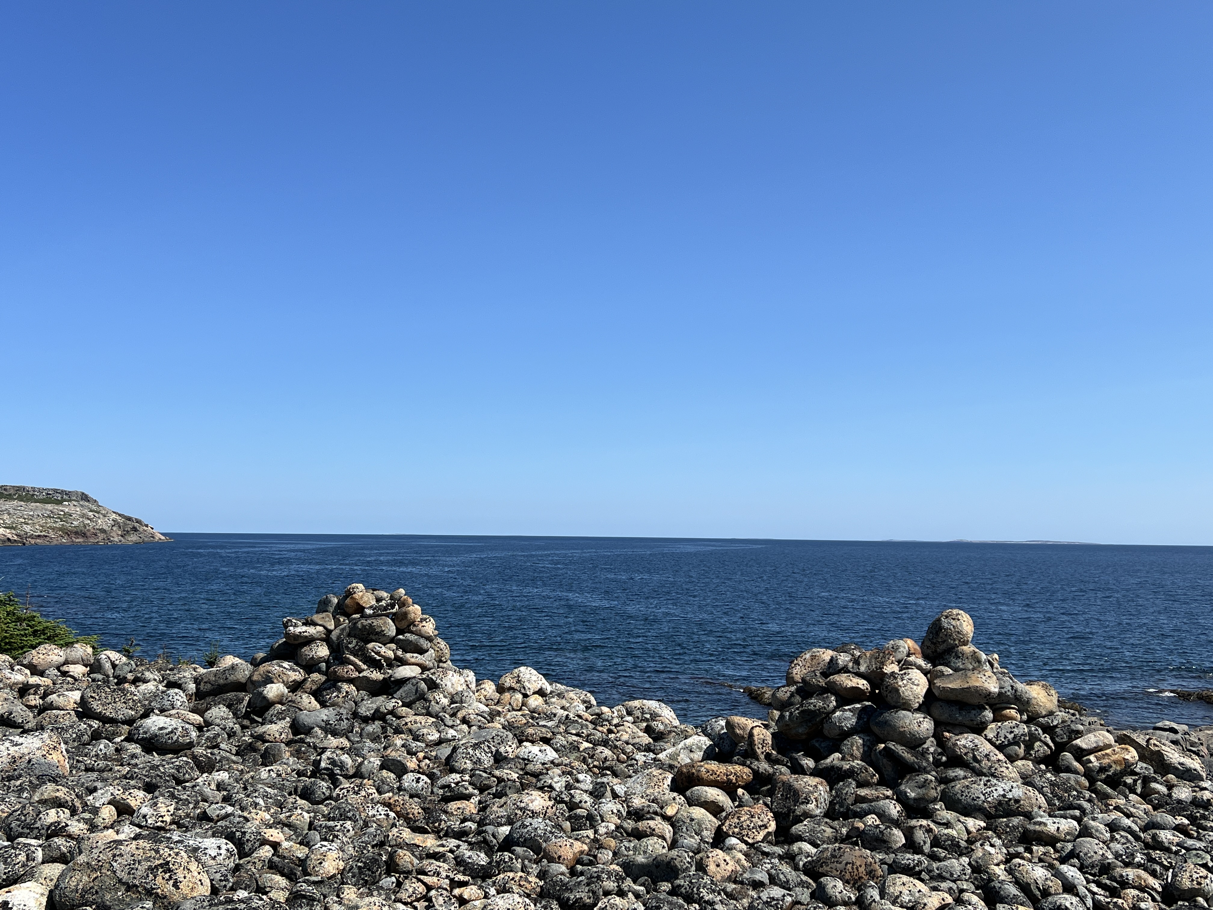
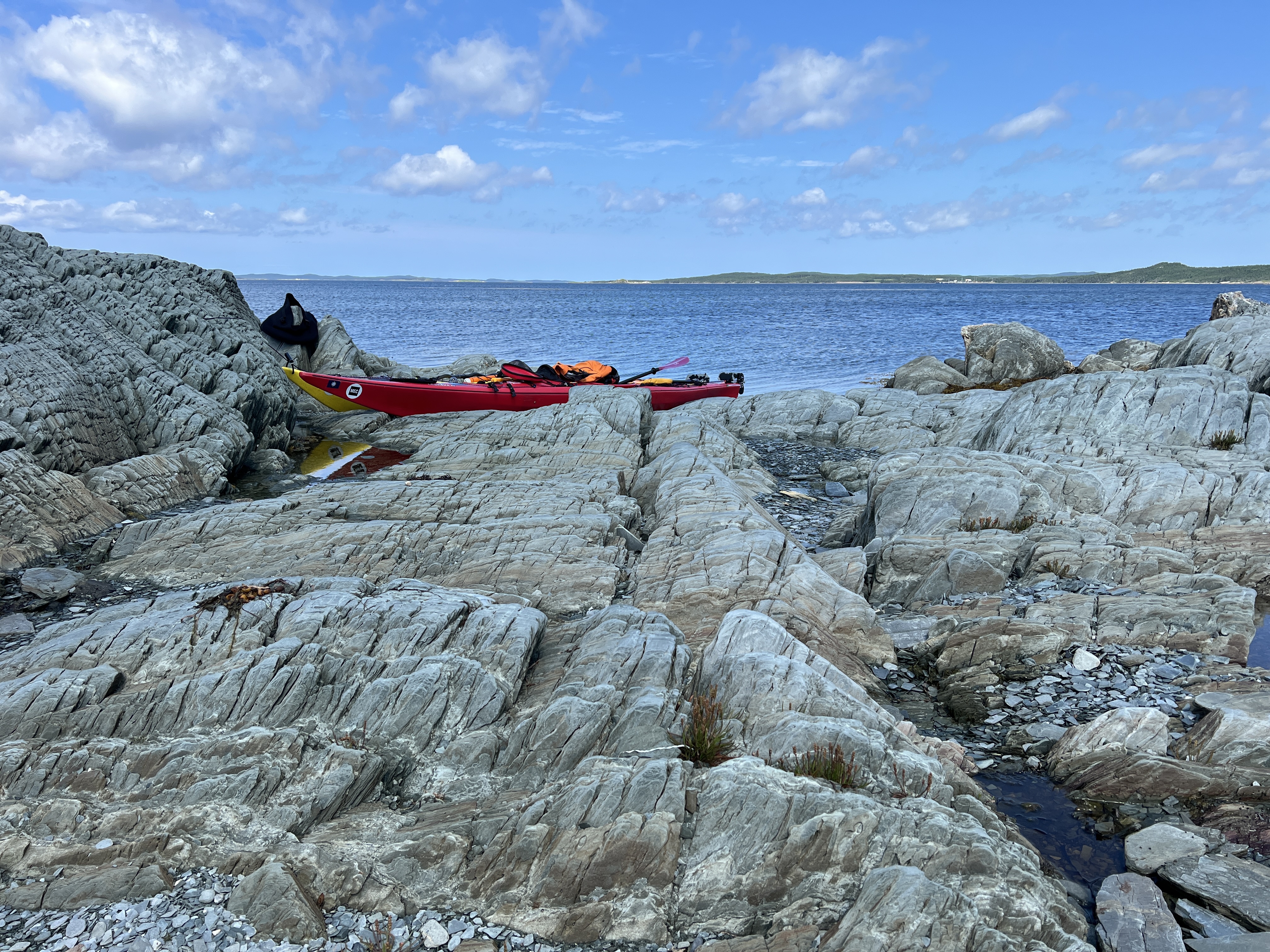
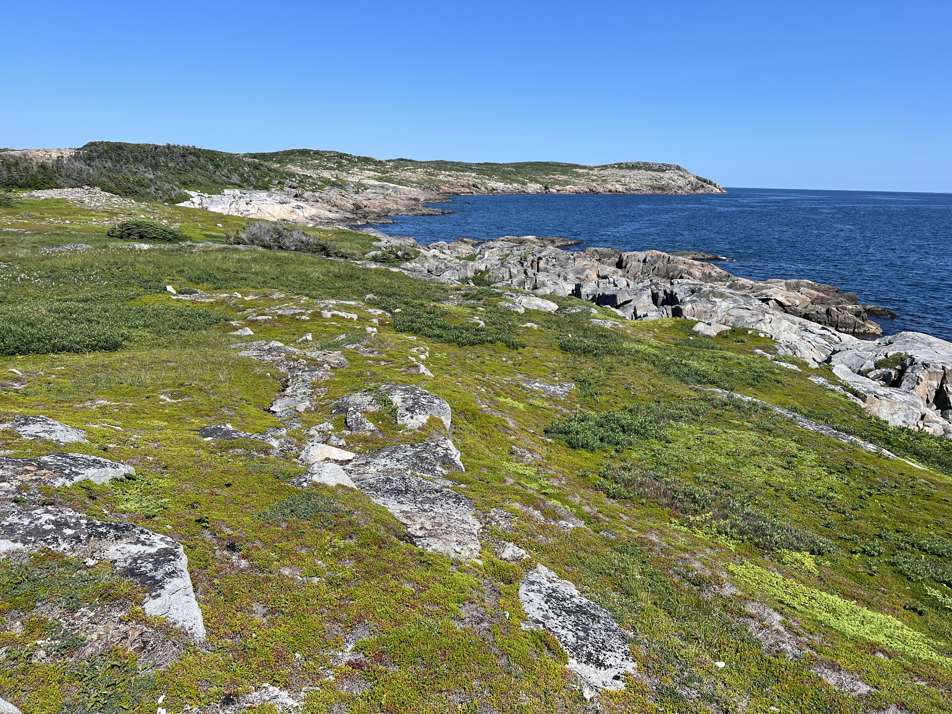
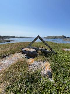
On our hike we spotted three mounds of stacked stones above the cove before Cape Fogo. We wondered if they were navigational aids, marked graves, or had some other purpose. If anyone knows, please drop us a note. The stones were covered in lichen so they have been piled there a long time. Marian is pointing to way we hoped to paddle.

Day Seven-July 21: Hip Your Partner
We are camped in Sandy Cove tonight and when we paddled in, it seemed like a tropical paradise.

Sandy, warm, and turquoise water had us pinching ourselves. Could this be real? It was indeed and we received such a warm welcome to Tilting and Sandy Cove from Bev Foley and Fraser Carpenter. We’re well fed, clean, and have enjoyed hours of conversation.

On the map you can see we rounded Cape Fogo this morning. We paddled around three sides of it and the colliding swells from the Southwest and North combined with the clapotus from the waves hitting the Cape-it it feel a bit like a square dance and that we were being hipped by the point. In I’s the B’y, the lyrics,
“Hip-yer-partner Sally Tibbo
Hip-yer-partner Sally Brown
Fogo, Twillingate, Moreton’s Harbour,
All around the circle refer to touching the hip of your dancing partner as your swing…ie as you go all around the circle.
Day Eight-July 22: Hip Your Whale of a Day
With the high wind and waves, we were invited to our first shore/rest day of the expedition. As we were finishing breakfast, Bev came by our campsite to say that if we could be there in 15 minutes, there was space for us on the boat tour to the Little Fogo Islands. We jumped into action to accept this most wonderful opportunity. Many thanks to @FogoIslandBoatTours including us!

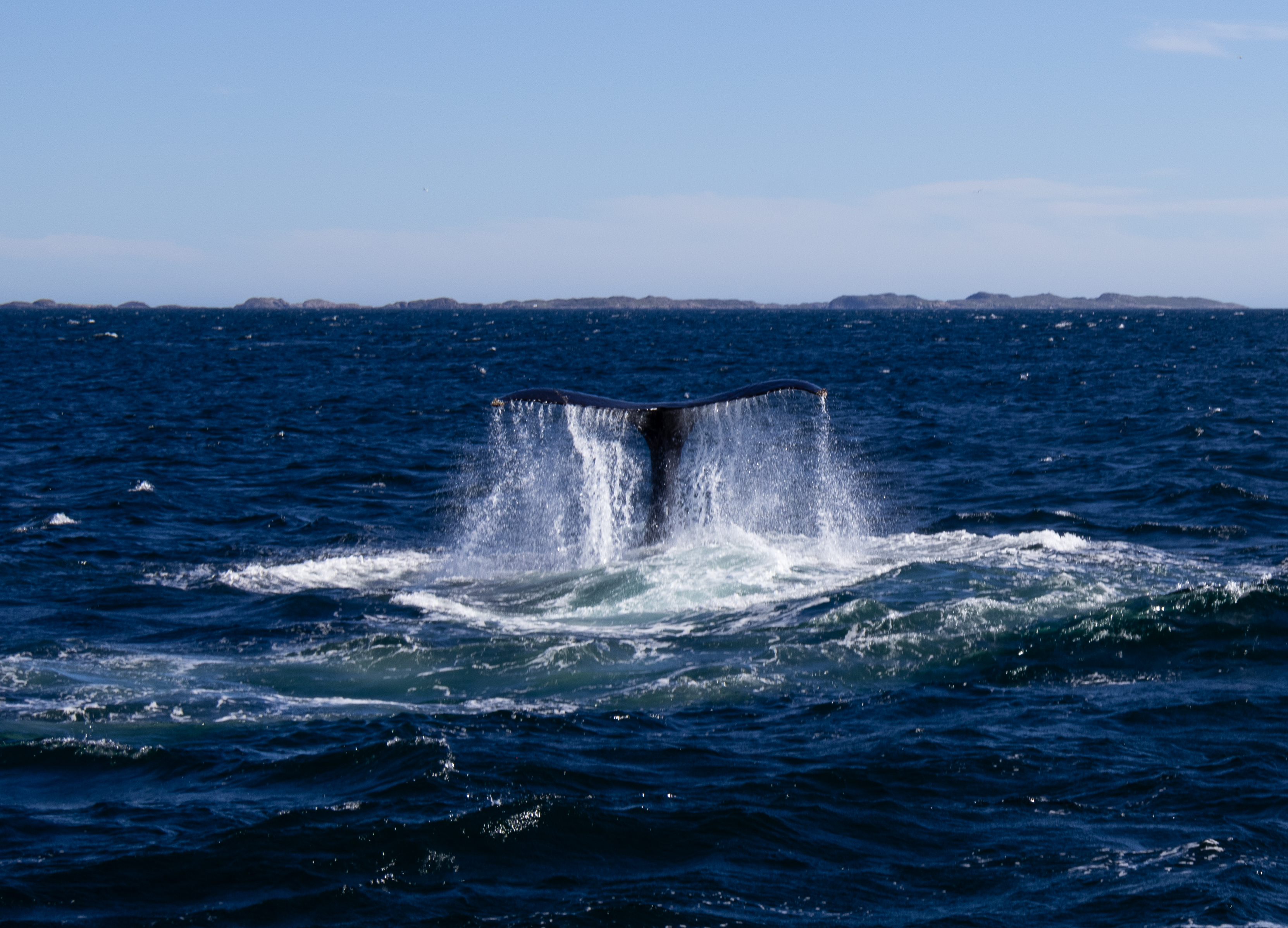
We enjoyed the fluke waving and other antics of two humpback whales on the way out to the islands and seeing perhaps the same two doing full body breaches on the way back in.

The Little Fogo Islands were (and still somewhat are) seasonally inhabited. Fishers used them as a base to reach further out fishing grounds. The islands are also home to about 100,000 puffins.
This evening, Fraser organized a community potluck where we could share our experiences of the expedition so far, meet members of the Fogo Island community, and talk kayaking. The food was delicious and it was such a pleasure to share our expeditions stories.
Day Nine-July 23: I’se the B’y Who Builds the Boat
We were winded off again today. We used the morning to prepare for our intended departure tomorrow by doing some making, marking maps, charging batteries, and ask local folks to share their knowledge of the coastline ahead.
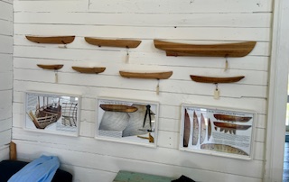
Chores done, we headed to the Punt Premises to catch up with an old friend, PJ, and make some new ones. The Punt/Shorefast Premises act as a cultural and historical holding place where visitors can learn about punts, fishing, traditional ways of living, boat building and the like.
We sat yarning and eating cod tongues and cheeks as well as jiggs dinner hash! We met some folks from Fogo Island Arts and even got to make seaweed cyanotype prints. The afternoon flew by and it was soon time to visit Fraser and Lee at their studio, Fogo Island Salt Fire Pottery.

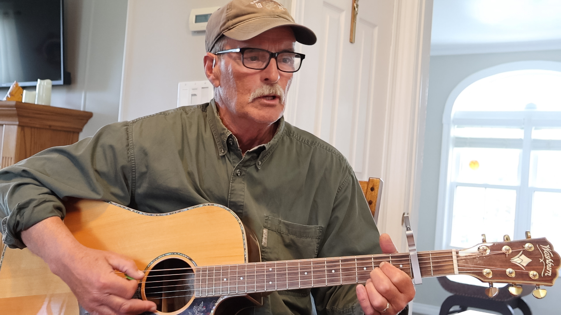
We were invited by Barbara Walbourne Mitchell, the chair of the Brimstone Culture and Historical Society to do some storytelling about expedition at the Old School House in Fogo. When we arrived, Gary Mitchell on vocals and guitar and Gerald Freake on the accordion played a rousing version of I’d the B’y.

We were so touched! Similar to last evening I told them about the RCGS Expedition grant, preparing for, and starting our expedition. It was fabulous to share the wonders we had seen along our expedition path All Around the Circle.

It looks like we will be on the move again tomorrow hoping to reach Fogo town by kayak rather than by car as we did today. I’m up early so I’ll sign off for now!

Day Ten-July 23: Paddle Magic Around Every Point
This will be brief. Today was awesome. Big paddling. Calm paddling. Cool paddling. Warm paddling. Paddling with whales. We paddled from Sandy Cove to Change Islands today.
Even cooler was magic around many points: friends coming out in fast craft to say hello and take photos, surprising a dear friend on her 77th birthday by appearing out of nowhere on Change Islands, having folks on the Canal Bridge that we met the night before cheer on the milestone of Fogo today, being met when arriving a day early on Change Islands and being welcomed like family, and falling into bed dead tired but so alive with the joy of human and place connection.
Day Eleven & Twelve-July 23-24: Codjacks Cove
A windy forecast kept us on the beach today. We have one more pivotal paddle rounding the top of South Twillingate Island to complete our All Around the Circle expedition. It’s has been pouring rain all morning starting just as we pitched the tarp (where there is cellular coverage on the other side of the beach) in time for me to do a VOCM interview that will air on Monday.

The past few days have been very full and rich. We left Sandy Cove with a bit of tail wind until we rounded around Round Head. There, we traded the wind push for a bit of current that helped us push against the headwind we had until we got to Fogo town.
The NW swell kicked up by entrance to the Lion’s Den and so we continued and found the seam between islands that got us to the edge of Fogo Harbour. A sweet beach on Simms Island invited us in and we landed after 4.5 hours in the boats. We took a long lunch and climbed up to the top of the island to enjoy the view.
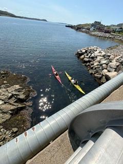
From there, I texted the Chair of the Brimstone Head Cultural and Historic Society that we’d be passing through “The Canal” (an opening) at the other end of the harbour. As we approached the bridge, we noticed several folks we’d met the night before on the bridge, waving to us. As we passed under the bridge, Gary Mitchell sang, I’s the B’y, to us once more.
We paddled South towards Deep Bay on an oily, reflective sea. In no time, we were at a decision point, do we stop and camp or put on a big push and cross to Change Islands in near perfect conditions. After kicking it around, we set course for the tickle (narrow channel of water) that separates the North Change Islands from the South. We’d already put in a full day’s paddling but the conditions were too good to pass up.

Ninety or so minutes later, we pulled past the outer islands that guard the tickle. My phone buzzed and beeped. We had an invite to spend the evening with the mayor of Change Islands! Paula (mayor and kayaker) and Dennis (town councillor and kayaker) welcomed us, toured us around, and fed us! It was only my second visit to Change Islands ( the first being in 1998) and Marian’s first. I enjoyed learning about the town, the recreation and seniors programs they run, and getting a sense of the community. We also dropped by to surprise a dear friend who was celebrating her birthday at her place on Change Islands.

After such a day wonderfully filled with challenging paddling and kind folks, we slept deeply with the plan to finish the crossing to Herring Neck the next day. It was hard to leave but we wanted an early start to get some kilometres in before the wind rose. We set course for Mile Island (technically about 2.6 km) off shore, then to Fishing Island. The wind picked up and stood the water up into waves that crested with white caps. Progress was slow and hard fought but eventually we pulled into the lee of Duck Island. It was like a different world. We took a breather and had a snack as a Coast Guard ship passed by.
Refueled, we paddled down Duck Island and then changed course again for the entrance of Pike’s Arm. The wind eased as we went and we pulled into a beach about an hour later for lunch. Using some tickles, some natural, some created we made our way through Herring Neck-where’d we thought we stop for the night. Realizing it was early afternoon, we made a plan to go out Gut Tickle and cross from New World Island to South Twillingate Island. We were lucky with our timing as the tide had changed and we were jetted through the opening on a river-like current.

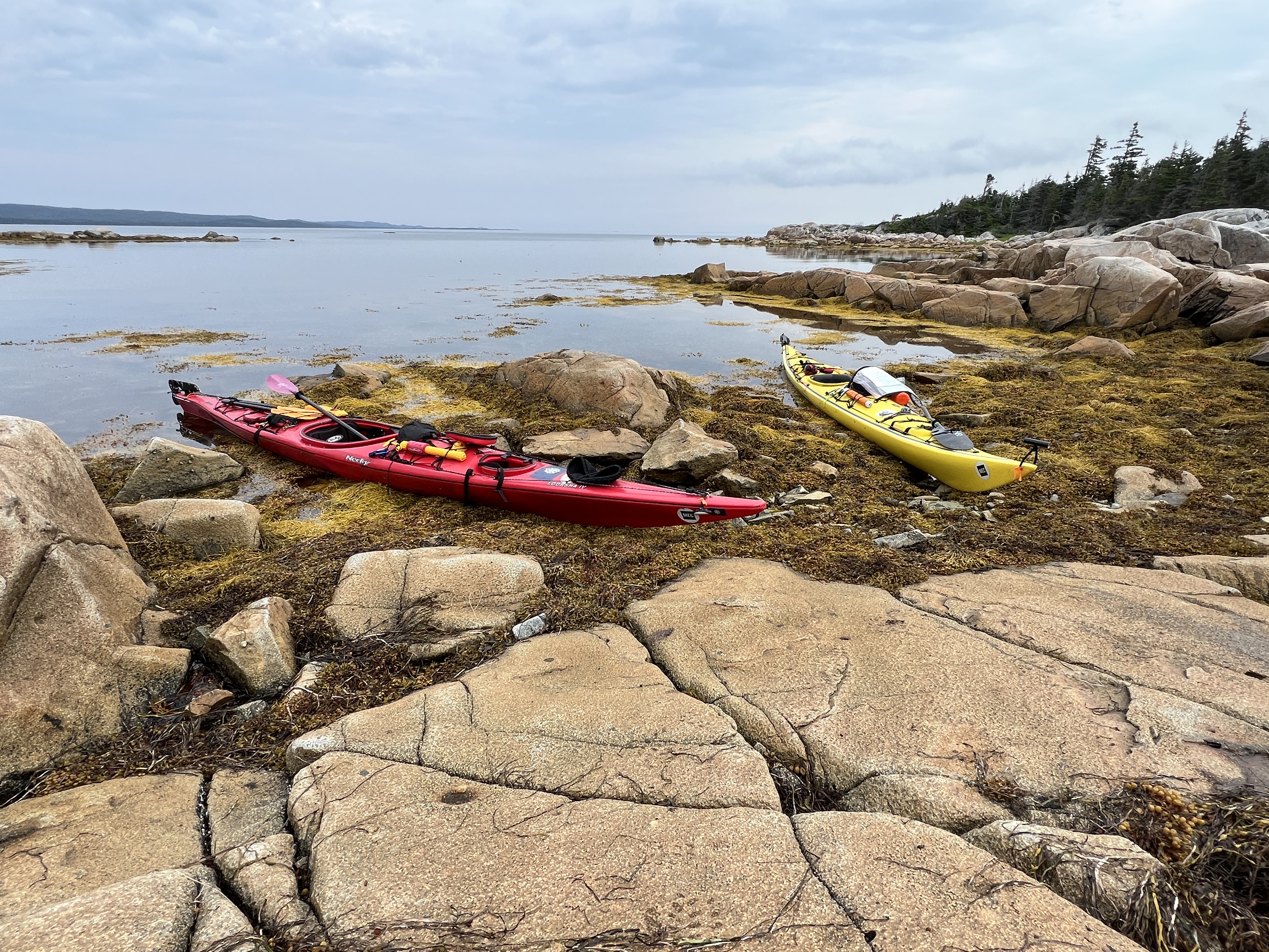
We set course for Little Harbour but didn’t find a beach that would let us land easily so we rounded Gunning Head and swung round into Codjacks Cove. So glad we did! Codjacks Cove is stunning, has a lovely beach for landing a kayak, and protection from wind ( as a storm was coming). It was home for the night which became home for two nights with today’s forecasted wind. So it’s been a layover, lay around, stay dry, use lulls in the rain to get a few things done kinda day. Maybe even a nap will make the to do list as well.
The nap was fantastic! We had hot lunch (butter chicken) which was nice on a cool and rainy day to warm us up from the inside out. It appears the rain has lulled so I’m going to pop out of the tent and send this off and get a weather forecast for tomorrow!

Day Thirteen-July 25: We Have Gone All Around the Circle

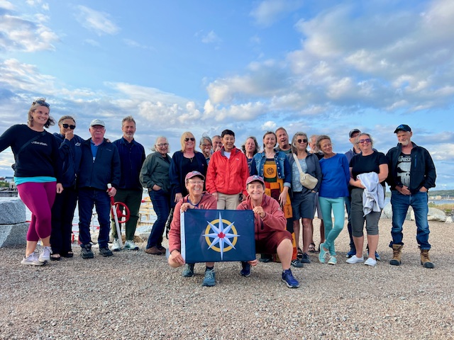
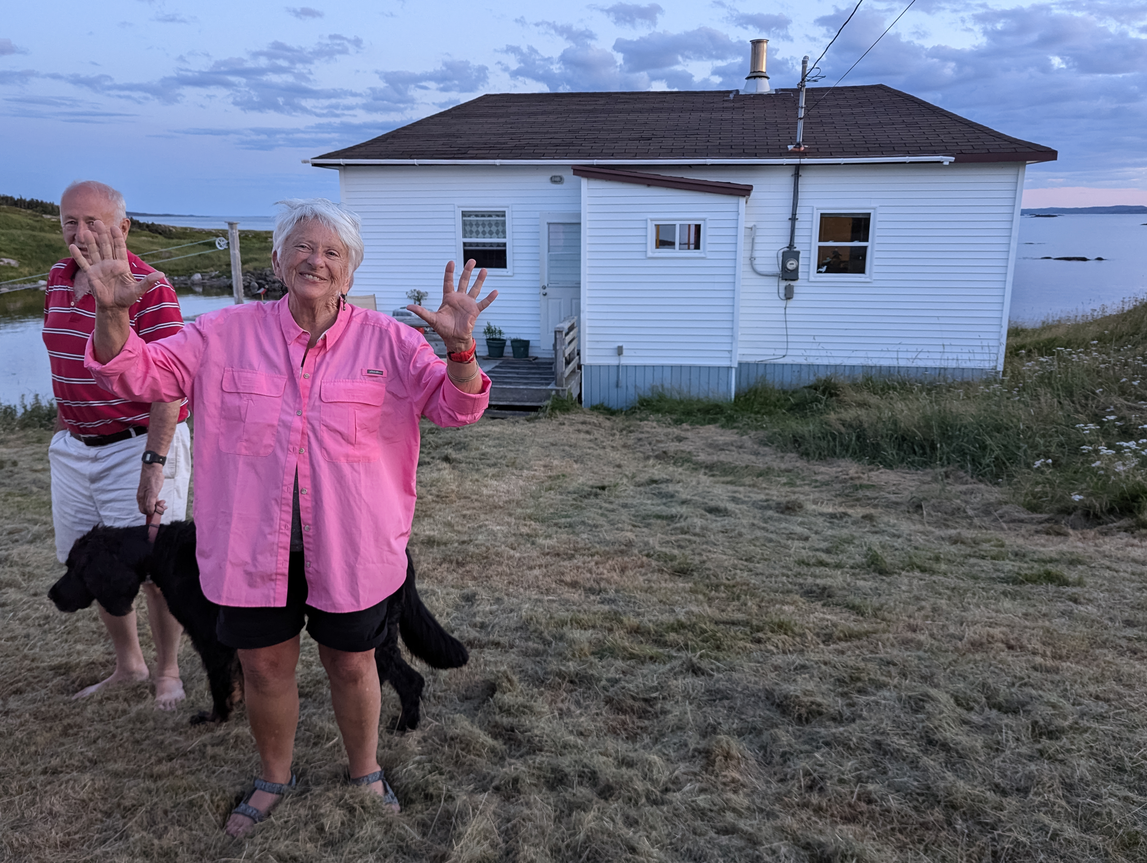
Oh We’ve gone all around the circle!! We landed this afternoon back on the beach from which we left. Big challenging conditions but so excited, proud, and thrilled to have completed our expedition so not many pictures of today’s paddle. Special thanks to the crew who welcomed us back-the same crew as sent us off!!!
")


